|
KV 13 (Bay)
General Site Information
Structure: KV 13
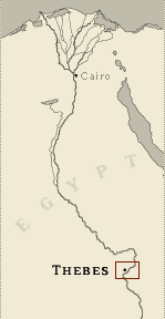
Location: Valley of the Kings, East Valley, Thebes West Bank, Thebes
Owner: Bay
Other designations: 19 [Hay], Commencement d'excavation ou grotte
fermée [Description], E [Burton], G (?) [Pococke]
Site type: Tomb
Description
The tomb of Bay is situated at the end
of the southwest branch of the southwest wadi, close to the tombs of
Sety II, Tausert and Siptah.The architecture and decoration closely
resemble that of the tomb of Queen Tausert.
It consists of three corridors (B, C, D) followed by two chambers
(E, F), two further corridors (G, H), two side chambers off the
second (Ha-b), and a burial chamber (J). The tomb has suffered
structural damage from floods, and all the ceilings of the tomb have
collapsed.
The walls were probably decorated originally with painted plaster
and relief. Severe floods have caused the loss of the plaster,
however, and now only traces of decoration remain in places where
the artist was working on thin plaster and the chiseling cut into
the bedrock. The remaining decoration echoes that in KV 14 and
represents the deceased with deities (corridor B, corridor D) and
parts of the Book of the Dead (corridor C).
Noteworthy features
This is one of the rare non-royal tombs
cut in the Valley during Dynasty 19. The tomb also demonstrates the
late Rameside practice of re-using abandoned tombs for the burial of
royal family members, containing two sarcophagi from this period.
Site History
The tomb was built for Bay, originally a royal scribe of Sety II and
later chancellor under Siptah. The privilege of being granted a tomb
in the Valley of the Kings reflects his status. The tomb, however,
was left unfinished and was later reused by the royal princes
Amenherkhepshef and Mentuherkhepshef in Dynasty 20.
A slight deviation in orientation between corridor G and corridor H
led Altenmüller to suggest that originally the tomb was only
finished until corridor G, and that corridor H and the burial
chamber J were additions in Dynasty 20. The tomb was partly
accessible since antiquity, but no late graffiti are recorded.
Dating
This site was used during the following period(s):
New Kingdom, Dynasty 19, Siptah
New Kingdom, Dynasty 20, Rameses III
History of
Exploration
Pococke, Richard (1737-1738): Mapping/planning
Napoleonic Expedition (1799): Mapping/planning
Belzoni, Giovanni Battista (1817): Visit
Burton, James (1825): Mapping/planning
Altenmüller, Hartwig (1988-1994): Excavation
Conservation
- Conservation history: During clearance, plaster was
applied to the walls and ceiling in the rear chambers. Following the
1994 floods, a covered passage was built over entryway A.
- Site condition: The tomb is located
beneath a cascade from the Valley of the Kings drainage basin above
the cliff. This position has made it particularly susceptible to
flooding. At least four floods were responsible for the extensive
damage to decoration and architecture, and they filled the tomb with
debris. As a result, most of the painted plaster sunk relief
decoration on the walls has been lost, with traces preserved only
when the artist cut into the stone surface beneath the plaster
coating. |
Printable Tomb Drawings
Axis in degrees: 292.91
Axis orientation: West
Site Location
Latitude: 25.44 N
Longitude: 32.36 E
Elevation: 184.87 msl
North: 99,406.200
East: 93,967.825
JOG map reference: NG 36-10
Modern governorate: Qena (Qina)
Ancient nome: 4th Upper Egypt
Surveyed by TMP: Yes
Measurements
Maximum height: 2.75 m
Minimum width: 0.85 m
Maximum width: 5.09 m
Total length: 71.37 m
Total area: 168.68 m²
Total volume: 381.67 m³
Additional Tomb Information
Entrance location: Base of sheer cliff
Owner type: Official
Entrance type: Ramp
Interior layout: Corridors and chambers
Axis type: Straight
Decoration
Sunk relief
Categories of Objects Recovered
Tomb equipment
Vessels
|