|
KV 16 (Rameses I)
General Site Information
Structure: KV 16
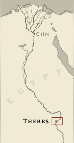
Location: Valley of the Kings, East Valley, Thebes West Bank, Thebes
Owner: Rameses I
Other designations: 11 [Hay], 16 [Lepsius], 2 [Champollion], 3
[Belzoni], X [Burton]
Site type: Tomb
Description
KV 16, located in the southeast wadi,
was unfinished at the time of Rameses I's death. Its axis is
oriented roughly to the southwest. The tomb is of a simple plan, and
has a stepped entryway (A), a sloping corridor (B) and a stairwell
(C), followed by the burial chamber J with three side chambers (Ja-c).
A pair of holes in the walls of corridor B served to hold a beam for
lowering the sarcophagus with the aid of ropes. The unfinished
trapezoidal recesses in corridor C are unusually wide. The burial
chamber J may have been intended to be larger if side chamber Jb is
an abandoned cutting. Two pairs of magical brick niches are set high
up on the side walls of burial chamber J, and side chamber Jb may
have served as the emplacement for the now-missing canopic chest.
The tomb is decorated with scenes from the Book of Gates (burial
chamber J, side chamber Jb) and scenes of the deceased with deities
(burial chamber J). KV 16 has suffered from flood damage.
Noteworthy features
Burial chamber J comes immediately after
the second corridor B.
Site History
Only the entryway and the first two corridors of KV 16 had been cut
when Rameses I died. The broken condition of the sarcophagus lid and
the upper edge of the box show that the tomb was plundered, perhaps
at the end of Dynasty 20 or in Dynasty 21. The mummy was eventually
cached in TT 320 in the tenth regnal year of Saamen after previously
being hidden in KV 17. The tomb entrance subsequently was covered
over, as the absence of any Greek or Latin graffiti attests.
Dating
This site was used during the following period(s):
New Kingdom, Dynasty 19, Rameses I
History of
Exploration
Belzoni, Giovanni Battista (1817): Discovery
Belzoni, Giovanni Battista (1817): Excavation (conducted for Henry
Salt)
Burton, James (1825): Mapping/planning
Lane, Edward William (1826-1827): Visit
Franco-Tuscan Expedition (1828-1829): Epigraphy
Lepsius, Carl Richard (1844-1845): Epigraphy
Piankoff, Alexandre (1957): Epigraphy
Conservation
- Conservation history: The Supreme Council of
Antiquities has installed four ceiling supports in the burial room
around the sarcophagus, the sarcophagus lid has been placed on the
box with repairs in tinted plaster made to breaks in both box and
lid. Wooden walkways, stairs and fluorescent lighting have been
added.
- Site condition: The stone in the tomb is fractured
and has suffered from flood damage. Rain water entered the tomb
through joints and faults in the surface limestone. The painted
decoration has also suffered from the floods: paint has flaked off
and the walls have cracked because of rock movement.
|
Printable Tomb Drawings
Axis in degrees: 240.41
Axis orientation: Southwest
Site Location
Latitude: 25.44 N
Longitude: 32.36 E
Elevation: 178.032 msl
North: 99,564.947
East: 94,122.665
JOG map reference: NG 36-10
Modern governorate: Qena (Qina)
Ancient nome: 4th Upper Egypt
Surveyed by TMP: Yes
Measurements
Maximum height: 4.96 m
Mininum width: 1.28 m
Maximum width: 6.26 m
Total length: 49.34 m
Total area: 147.94 m²
Total volume: 283.83 m³
Additional Tomb Information
Entrance location: Base of sloping hill
Owner type: King
Entrance type: Staircase
Interior layout: Corridors and chambers
Axis type: Straight
Decoration
Painting
Categories of Objects Recovered
Human mummies
Sculpture
Tomb equipment
|