|
KV 1 (Rameses VII)
General Site Information
Structure: KV 1
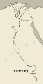
Location: Valley of the Kings, East Valley, Thebes West Bank, Thebes
Owner: Rameses VII
Other designations: 1 [Hay], 1 [Lepsius], 7 [Champollion], A [Pococke],
Ier Tombeau à l'ouest [Description], O [Burton]
Site type: Tomb
Description
The entrance is cut into the base of a hill at the end
of the first northwest branch wadi. This unfinished tomb comprises
an open entryway ramp (A), corridor B, vaulted burial chamber J, and
an unfinished chamber (K) with a rear recess. The walls are
decorated with excerpts from the Book of Gates (chamber K), Book of
Caverns (corridor B), Book of the Earth (burial chamber J), Opening
of the Mouth ritual (corridor B), and the deceased with deities (corridor
B, chamber K, burial chamber J). The ceilings are painted with
motifs of flying vultures and astronomical figures. There are 135
Greek, and several demotic, Coptic, and nineteenth century graffiti
in the tomb, indicating that KV 1 has been accessible since
antiquity.
Noteworthy features
The conversion of the second corridor to a
burial chamber is noteworthy. Its central two-tiered pit in the
floor, provided with canopic jar niches in the sides, is unique.
The figure of the king with the goddesses adoring the sun disk on
the outer lintel of gate B is a first.
This is one of the latest tombs to be cut in a side wadi.
It was used as a dwelling by Coptic monks.
Site History
At the time of the king's death in his seventh regnal year, work on
the tomb's third corridor (now chamber K) was abandoned and the
second corridor was enlarged and became burial chamber J. A break in
the end of the granite pit cover was made by robbers to gain access
to the burial. The tomb was used by Christian monks or hermits as a
dwelling.
Dating
This site was used during the following period(s):
New Kingdom, Dynasty 20, Rameses VII
Byzantine Period
Graeco-Roman Era
History of Exploration
Pococke, Richard (1737-1738): Mapping/planning
Napoleonic Expedition (1799): Mapping/planning (plan and section,
and recording of decoration details)
Burton, James (1825): Mapping/planning
Wilkinson, John Gardner (1825-1828): Visit
Hay, Robert (1825-1835): Mapping/planning (drawings of tomb and
sarcophagus)
Lane, Edward William (1826-1827): Visit
Franco-Tuscan Expedition (1828-1829): Epigraphy
Lepsius, Carl Richard (1844-1845): Epigraphy
Ayrton, Edward Russell (1906): Excavation (reopening of the tomb and
removal of the coffin containing the mummy of Rameses VII to the
Cairo Museum, filled in entrance to tomb, the location of which was
then forgotten)
Service des Antiquités (1952 (or later)): Excavation
Piankoff, Alexandre (1958): Photography
Brock, Edwin C. (1983-1984, 1990, 1994): Excavation (search of
burial pit, dump, and foundation deposit for the Royal Ontario
Museum)
Conservation
-
Conservation history: In 1994, the Supreme Council of Antiquities
cleaned the tomb's walls and filled cracks in walls and ceiling with
plaster. Some ancient graffiti were covered over in the process. In
the same year, the Supreme Council of Antiquities created a walkway
from the paved road to the tomb entrance and built a wood shelter
with cement benches nearby. A wooden floor, railings, and large
glass panels have been installed throughout the tomb.
-
Site condition: There are major cracks in the walls and ceilings of
corridor B. The plaster is intact where it is not damaged by cracks,
vandalism, or later graffiti. The paint is in good condition,
although much blue pigment has fallen away. |
Printable Tomb Drawings
Axis in degrees: 327.72
Axis orientation: Northwest
Site Location
Latitude: 25.44 N
Longitude: 32.36 E
Elevation: 171.219 msl
North: 99,803.743
East: 94,006.256
JOG map reference: NG 36-10
Modern governorate: Qena (Qina)
Ancient nome: 4th Upper Egyptian
Surveyed by TMP: Yes
Measurements
Maximum height: 4.25 m
Minimum width: 2.74 m
Maximum width: 5.17 m
Total length: 44.3 m
Total area: 163.56 m²
Total volume: 463.01 m³
Additional Tomb Information
Entrance location: End of spur
Owner type: King
Entrance type: Ramp
Interior layout: Corridor and chambers
Axis type: Straight
Decoration
Grafitti
Painting
Sunk relief
Categories of Objects Recovered
Architectural elements
Domestic equipment
Furniture
Tomb equipment
Vegetal remains
Vessel stands
Written documents
|