June 20, 2019

from Ancient-Origins Website


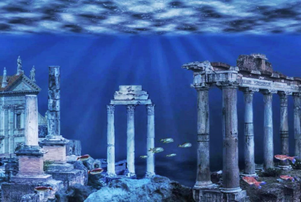
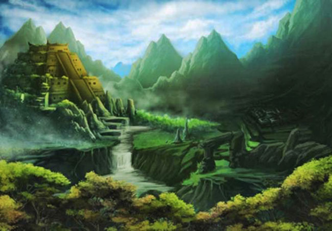
Imaginary ruins of a sunken kingdom.

Source: manjik /Adobe Stock


Some of the most exciting archaeological discoveries and mysteries are the ones involving the ancient ruins of kingdoms lost beneath the waves.


There is something about the underwater world that captures our imagination - perhaps it is the curiosity and intrigue about what may lie beneath the surface, or the idea that entire cities may be concealed on the ocean floor, out of sight and out of reach.


Sometimes marine archaeologists are lucky enough to make incredible discoveries, but several of the sunken kingdoms in this article remain hidden:

they're legendary lands wrapped in ancient myths...


The Quest for the Mythical Submerged Temples of Mahabalipuram


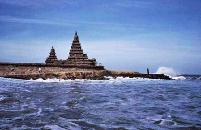
Shore Temple.

Mahabalipuram, India.

(University of Southampton)


Mahabalipuram is an ancient city located in the Kancheepuram district of the southern Indian state of Tamil Nadu.


The 'Seven Pagodas of Mahabalipuram' was one of the architectural achievements of the Pallava Dynasty (3rd - 9th century AD).

Myths say the beauty of Mahabalipuram aroused the jealousy of Indra, the deva of rain and storms, so the deity submerged the city under the sea during a great storm.


Only the Shore Temple, still visible today, was left above the water as evidence that this beautiful city had once existed. Evidence for the submerged temples emerged following the devastating tsunami that occurred December 26, 2004.


During the tsunami, it was reported that,

"a long, straight row of large rocks emerge(d) from the water just before the waters rushed back again."

The force of the tsunami managed to expose some objects that were covered by centuries of silt.

These objects include a large stone lion found on Mahabalipuram's beach, as well as a half-completed rock relief of an elephant.


The recent discoveries have sparked renewed interest in the Mahabalipuram legend and many say the myth of the seven submerged temples might one day be considered a true historical event.


Lost Land of Lyonesse - Legendary City on the Bottom of the Sea


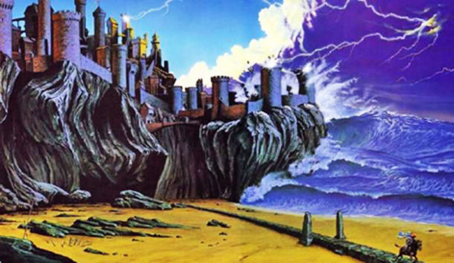
Artist's depiction of

Lyonesse being swept away.

( AnnoyzView)


In Arthurian legend, Lyonesse is the home country of Tristan, from the legendary story of Tristan and Isolde.


It's now referred to as the "Lost Land of Lyonesse," as it is ultimately said to have sunk into the sea.

Prior to its sinking, Lyonesse would have been quite large, containing 140 villages and churches. It's said to have disappeared on November 11, 1099 (although some tales use the year 1089, and some date back to the 6th century).


Very suddenly the land was flooded by the sea, entire villages were swallowed, and the people and animals drowned. Once it was covered in water, the land never re-emerged.

While the Arthurian tales are legendary, there is some belief that Lyonesse was once a very real place attached to the Scilly Isles in Cornwall, England.


Evidence shows that sea levels were considerably lower in the past, so it's possible that an area that once contained a human settlement above-ground is now beneath the sea.


Indeed, fisherman near the Scilly Isles tell tales of retrieving pieces of buildings and other structures from their fishing nets.


These stories have never been substantiated, and are viewed by some as tall tales...


Cantre'r Gwaelod - The Mythical Sunken Kingdom of Wales


Cantre'r Gwaelod, or The Lowland Hundred:

The stumps are the remains of an ancient submerged forest

that extends along the coast. Is this a long-lost sunken kingdom?

(Richerman/ CC BY SA 3.0 )


During the sixth century, a legendary kingdom known as Cantre'r Gwaelod (meaning 'The Lowland Hundred') was said to have been ruled over by a king by the name of Gwyddno Garanhir.


Up to around the 17th century, Cantre'r Gwaelod was known as Maes Gwyddno (meaning 'Gwyddno's Land'), so named after this Welsh ruler.


An earlier version of the legend associated with Maes Gwyddno asserts that the land was submerged under water when Mererid, a priestess of a fairy well, allowed the water to overflow, sinking the kingdom forever.

Several decades ago, the emergence of prehistoric forests during stormy weather in Cardigan Bay, in the west of Wales, led to the suggestion that it may be the location of the legendary Cantre'r Gwaelod.

Indeed, investigations revealed a wattle walkway with associated posts, fossilized human and animal footprints, as well as some human tools.


The location of the ancient kingdom is now believed to lie between Ramsey Island and Bardsey Island in Cardigan Bay, and to extend about 32 km (19.88 miles) west of the current shoreline into the bay.


The Lost City of Aztlan - Legendary Homeland of the Aztecs


Artist's representation of

an Aztec temple in a mystery land.

Aztlan is the Aztec's legendary homeland.

( Christopher /Adobe Stock)


Aztlan is the legendary homeland of the Aztec prior to their migration to the Valley of Mexico.


Some believe it is a mythical land which will live on through legend but will never be found in physical existence.

Others say it's a true, physical location that will someday be identified. Searches for the land of Aztlan have spanned from Western Mexico all the way to the deserts of Utah.


However, these searches have been fruitless, as the location - and existence - of Aztlan remains a mystery.

The word Aztlan means,

"the land to the north; the land from whence we, the Aztecs, came."

In some tales, Aztlan is viewed as a land of paradise, specifically an island on a lake, for all inhabitants.


However, the Aztecs fled the island when a tyrannical elite took hold. Their migration from Aztlan to Tenochtitlán began on May 24, 1064, which was the first Aztec solar year.


Ancient Egyptian City of Heracleion - On the Border Between Myth and Reality


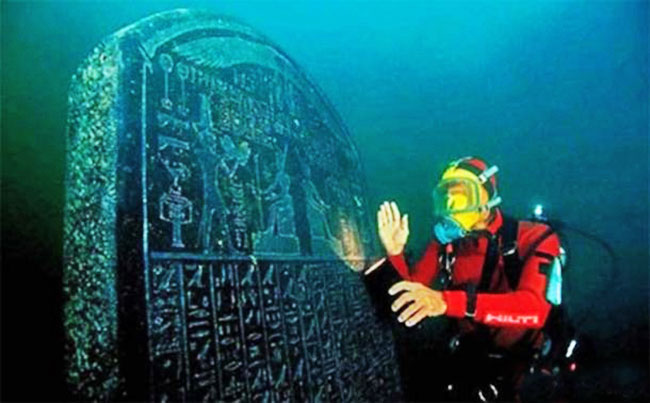
An amazingly well-preserved 1.9-metre-tall Heracleion stele

commissioned by Nectanebo I in 378 - 362 BC,

complete with detailed and clearly readable inscriptions.

(Cristoph Gerigk)


The city of Heracleion, home of the temple where Cleopatra was inaugurated, plunged into the Mediterranean Sea off the coast of Egypt nearly 1,200 years ago.


It was one of the most important trade centers in the Mediterranean before it sank more than a millennium ago.

For centuries, the city was believed to be a legendary land linked to the mythical hero Heracles and Helen and Paris, lovers from the Trojan War.


But in 2001 an underwater archaeologist searching for French warships stumbled across the sunken city.

After removing layers of sand and mud, divers uncovered the extraordinarily well-preserved city with many of its treasures still intact; including,

  • the main temple of Amun-Gerb

  • giant statues of pharaohs

  • hundreds of smaller statues of gods and goddesses

  • a sphinx

  • 64 ancient ships

  • 700 anchors

  • stone blocks with both Greek and Ancient Egyptian inscriptions

  • dozens of

  • gold coins

  • weights made from bronze and stone

It was one of the most significant underwater discoveries in over a decade.


Hedonistic Sunken City of the Caesars Recaptured by Divers After 1700 Years


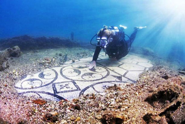
A diver explores the

Baiae Underwater Archaeological Site.

(Antonio Busiello)


The sunken city of the Caesars, Baiae, was lost for over 17 centuries under the blue waters of Italy's west coast. It was only rediscovered in recent years.

Baiae was the Las Vegas of First Century Rome, when the city became synonymous with luxury and wild parties that included a lot of wine and hedonism of the highest possible order.


In its heyday, Baiae was regularly visited by famous Roman Caesars including Julius Caesar, Nero, and Hadrian - who died there.

This may explain why Baiae is called "The Sunken City of the Caesars."

It was considered one of the most important Roman cities for centuries.


Pliny used to live here and from here, across the gulf, he witnessed and described the 79 AD eruption of Mount Vesuvius that destroyed Pompeii and Herculaneum.

Inevitably, much of the city was lost to the sea, as volcanic activity also caused the coastline to retreat 400 meters (1312.34 ft.) inland, forcing it underwater into what is now the Gulf of Naples.


The 5,000-Year-Old Sunken City in Southern Greece


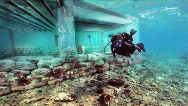
The original foundations of the city

underneath the reconstructed pillars and walls

of one of the buildings.

(Discovery)


Pavlopetri is a small village in the Peloponnesus region of southern Greece where an ancient city dating back 5,000 years resides about four meters (13.12 ft.) underwater.


It's believed to be the oldest known submerged city in the world.

The city is incredibly well-designed with a central square, roads, two story houses with gardens, temples, a cemetery, and a complex water management system including channels and water pipes. The design surpasses many modern cities.

The city is so old that it existed in the period that the famed ancient Greek epic poem 'Iliad' was set in.


Research in 2009 revealed that it had been inhabited prior to 2800 BC. Scientists estimate that the city sunk around 1000 BC due to earthquakes that shifted the land.

Historians believe that the ancient city was a Minoan and Mycenaean center for commerce. Scattered all over the place there are large storage containers made from clay, statues, everyday tools, and other artifacts.


The name of the city is still unknown.


Tracking Down the Submerged City of Helike


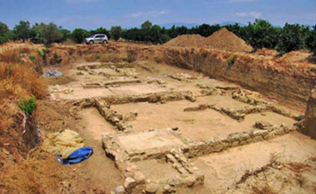
Excavations at the site of Helike.

In this case, a Hellenistic-era building;

possibly used as a dye-works.

(Drekis/ CC BY SA 3.0 )


The legendary ancient city of Helike was situated in Achaea on the northwestern part of the Peloponnesian peninsula.


During its heyday, it was the leader of the first Achaean League, a confederation that consisted of 12 cities in the surrounding area.

Due to this position, Helike was an important economic, cultural, and religious center. The patron god of Helike was Poseidon, the Greek god of the sea and earthquakes. This is unsurprising, given Helike's position in one of the most active earthquake zones in Europe.

One night during the winter of 373 BC, the city of Helike was obliterated.


Some signs of the city's impending doom were recorded, including the appearance of 'immense columns of flames' and the mass migration of small animals from the coast to the mountains several days prior to the disaster.

A major earthquake, followed by a large tsunami from the Gulf of Corinth destroyed the city. The rescue party that came the following morning found no survivors.


It was not until 2001 that the ruins were finally unearthed and only in 2012, when the destruction layer was uncovered, that the site was confirmed as Helike.


Kásskara - Sunken Land of the Hopi Ancestors


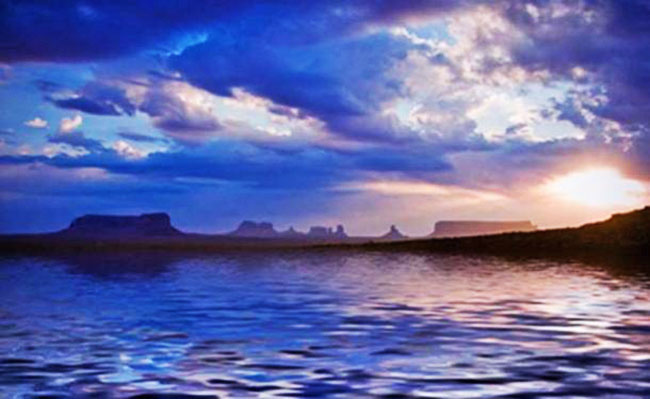
Deriv; A drowned land.

(Flickr/ CC BY-NC 2.0 )


The Hopi Indians represent the oldest continuous Native American group in the current United States.


They claim they did not come to North America across the Bering Strait, but north from South America, specifically from a land called Kásskara.

Kásskara is said to have been a continent that sank into the Pacific Ocean about the same time as Atlantis went down.


Hawaii is a remnant of the Hopi ancestors' original motherland, and Rapa Nui (Easter Island) is the last remaining of several islands that helped Kásskaran refugees cross the vast expanse of ocean to South America.

Legends say the lost land was almost a paradise at first and people lived well, ate well, and worked enough but not too much.


People had high morals and lived peacefully for a time. But when men began to lose respect for one another and fought with the Atlanteans both continents met their demise.


Atlantis of Britain - Prehistoric Territory of Doggerland Prepares to Unveil its Secrets


The Mesolithic people of Doggerland.

(Alexander Maleev)


Doggerland, sometimes called the Stone Age Atlantis of Britain or a prehistoric Garden of Eden, is thought to have been first inhabited around 10,000 BC.


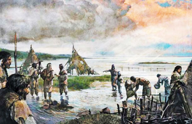
Located in the North Sea, Doggerland is believed to have once measured approximately 100,000 square miles (258,998 square kilometers).

However, the end of the Ice Age saw a big rise in sea level and an increase in storms and flooding in the region, causing Doggerland to gradually shrink.


Prehistoric humans living in the region lost their homes when catastrophic floods covered the territory sometime between 8000 - 6000 BC.

The location is known for providing prehistoric animal bones and, to a lesser extent, human remains and artifacts.


Researchers have mapped the seabed to track how climate change had an impact on Doggerland and the succession of cataclysms that turned it into a sunken land.