|
 |
 |
|
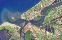
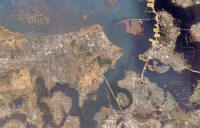
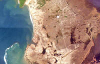
BEFORE:
This detailed view of the northern tip of the island was
taken on Jan 10, 2003
|
AFTER: A
photo taken of the same area on Dec. 29, 2004, shows the
extreme destruction caused by the earthquake and
tsunami. On Thursday, Indonesian officials issued a new
death toll of nearly 80,000 for that country alone.
|
|
 |
 |
|
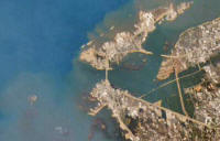
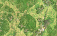
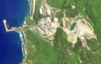
BEFORE:
This detailed view of northern Banda Aceh was taken on
Jan. 10, 2003
|
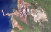
AFTER:
News services on Thursday reported that pilots in
Sumatra had discovered about 28,000
more dead in Banda Aceh while dropping food to remote
villages still unreachable by rescue workers.
|
|
 |
 |
|
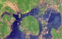
BEFORE:
This detailed view of the island was taken by the IKONOS
satellite on Jan. 10, 2003
|
AFTER:
Some officials said there was dismal coordination among
the Indonesian military, civilians and foreign
governments. "We haven't gotten any help at all,
nothing, said a resident who was camped out five miles
from the airport in Banda Aceh. |
|
 |
 |
|
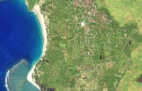
BEFORE:
This detailed view of the west of the island was taken
on Jan. 10, 2003
|
AFTER: As
of Thursday, several governments had pledged $500
million in emergency aid for stricken areas.
|
|
 |
 |
|
BEFORE:
This detailed view of the west of the island was taken
on Jan. 10, 2003
|
AFTER: On
Wednesday, the Indonesian military finally reached the
Sumatra town of Meulaboh, closest to the epicenter on
the massive earthquake. A bulldozer dug a mass grave the
size of a swimming pool in which to pile corpses covered
only by plastic sheets. |