|
Sat Dec 1, 2007 from ExopoliticsYahooGroup Website
Aloha, a very large artifact has appeared on Google Earth which depicts a rectangular green/orange object that is 80 km (50 miles) long and approximately 1 km wide, and nearby is another black rectangular artifact that is about half the size (40 km/25 miles). The green/orange object looks artificial and the melting snow is exposing what appears to be a massive artificial structure.
The black object looks very much like the monolith in Kubrick's 2001.
Both objects are parallel.
One can verify the existence of the two objects using the
latest
version of Google Earth. If the Google Earth images are accurate,
this may well turn out to be very large artifact(s) from an earlier
civilization in Greenland.
from
Rense Website
The mysterious object is located in the country of Greenland, which even today is melting at an incredible rate. We will look at this mysterious Greenland Object someone has found on Google Earth, which also has at least one spooky-music youtube video (above video) describing it. Polar North is indicated in all images.
The youtube video shows what can happen when image data falls into the hands of someone without an understanding of satellite imaging problems, and who may not look for rational explanations.
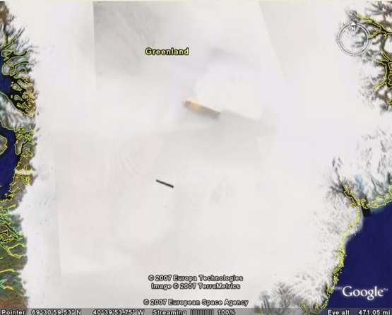
Fig. 1 Untouched overview from Google Earth of long yellow and black object measuring about 79.83 Km. long.
A black rectangular object appears to
accompany it. Image of Greenland (like most all Google Earth images) is constructed of a mosaic of images taken from satellites. These images are taken in overlapping bands as these satellites orbit the Earth. Lighting conditions vary with each exposure causing edges of individual images to mis-match. Resulting mis-matched image borders create faint diagonal, horizontal and vertical lines.
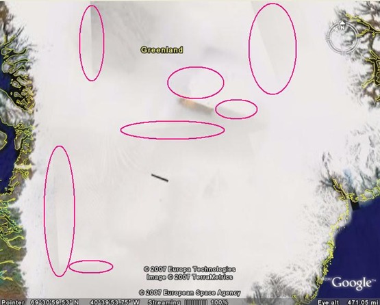
Red circles added here indicate some of
the individual mosaic borders for various individual image areas.
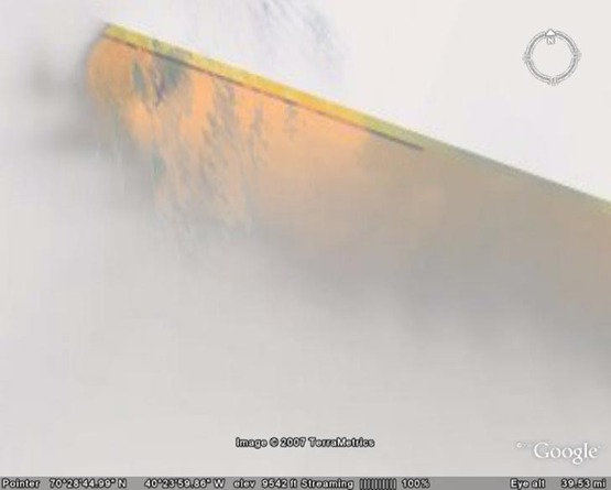
Closeup of the mysterious object in question. Here were can see that this object is simply a glimpse (in color) of the landscape below. A false color yellow band is visible along the top edge of the orange area, and can occur during image overlap. This image segment may have been imaged by a different satellite on a cloudless day, or imaged on a different day or perhaps even a different year.
Various light and dark areas of the area
in question also tend to be similar to those of the normal white
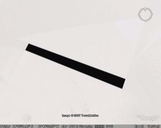
image area shown just above it. Closer view of the mysterious black object in Fig. 1. What we see here is a total absence of any image in this area.
Perhaps data was missing from the
original image mosaic. There are many reasons for the black rectangle in Fig. 4 including operator error during image alignment, satellite data dropouts, computer file processing errors, censoring, etc... Data for any satellite image travels a VERY long journey from the time the image data reaches Earth to Google Earth's image database.
However, it's highly unlikely the black rectangle itself is an actual object. Though various articles and videos on the web focus more on the larger color rectangular object (see Fig. 1.) the absence of any image area here is actually more intriguing.
If similar black rectangles do not
appear on other Google Earth images and in this image of Greenland,
then perhaps something was actually found here we are not
supposed to see.
|