|

by Jim Dobson
January 11,
2016
from
Forbes Website
Many explorers have died searching for Paititi: the Lost City of
Gold, and many became convinced that the city was hidden in the
last undiscovered regions of the Amazon.
The infamous journeys to
discover Paititi were also what inspired Sir Arthur Conan Doyle
to write "The Lost World."
Much has been documented about the divine sense of quest to discover
this magical kingdom. From treasure hunters to archaeologists and
explorers, Paititi has until now remained the subject of lore and
tribal legend spread through generations.
But now, a remote
location in the Peruvian Amazon thought to be the legendary Lost
City has been discovered and is the target for a professional
expedition taking place this summer.
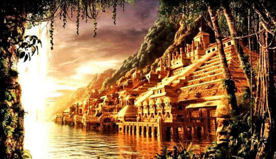
The search for Paititi:
The Lost City of Gold
Inca traditions mention a city, deep in the jungle and east of the
Andes area of Cusco which could be the last Incan refuge following
the Spanish Conquest.
The Spanish conquistadors
pillaged Cusco for its gold and silver, they only discovered a small
amount of bounty in the capital, and the bulk of the mass treasure
has never been found.
Just recently
a Spanish Galleon that sunk over
300 years ago, was discovered off the coast of Columbia and possibly
holding billions of dollars worth of treasure looted from Peru.
In 2001, Italian archaeologist Mario Polia discovered the
report of a missionary named Andres Lopez in the Vatican
archives.
In the document, which
dates from 1600, Lopez describes in great detail, a large city rich
in gold, silver and jewels, located in the middle of the tropical
jungle called Paititi by the natives.
Lopez informed the Pope
about his discovery and
the Vatican has kept Paititi's location
secret for decades.
Due to the remote location of the area, as well as dense mountains
that have to be traveled, it is no wonder that Paititi remains so
hard to find. Currently drug trafficking, illegal logging and oil
mining are overtaking this part of Peru, and many amateur explorers
that enter are often killed.
Legendary explorer Greg Deyermenjian explains his
extraordinary devotion to the area,
"The quest for
Paititi, for the furthest presence of the Incas into the selva
(jungle)
beyond the ranges, began for me after having visited, in 1981,
the site of Vilcabamba, the redoubt of Manco Inca - who did
finally rebel against the Spaniards after enduring nearly three
years of their increasingly harsh rule - at Espíritu Pampa in
the forested plains of La Convención province to the northwest
of Machu Picchu.
It was then that I
began to hear about a site which lay hidden somewhere off to the
east, where the Andes and the Amazonian rain forests meet in a
riot of hills, ravines, and isolated peaks, all covered in
jungle and crisscrossed by unnavigable boulder-strewn rivers and
streams.
And in 1984 I began
traveling there, to the north and northeast of Cusco, first in
the company of Cusqueño hunters who had made forays well past
their holdings in Paucartambo, and then with the
Quechua-speaking highland campesinos of Challabamba and Calca
that I had met through them."
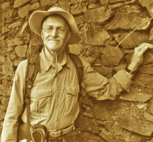
Famed explorer
Greg Deyermenjian
"Beginning in 1994, we allied ourselves with Peru's foremost
living explorer, Dr. Carlos Neuenschwander, who had been
conducting his own investigation into Paititi and the
significance of the Pantiacolla plateau since the 1950's.
We were unable to
raise funds sufficient for a helicopter, so we found ourselves
following branches of the main trail that traverses the
Paucartambo Mountains, down to the jungles of Callanga,
southeast of Mameria, where we investigated potential sites that
were spotted from the air by Dr. Neuenschwander years before.
We found the very
rough and decayed remains of an ancient Incan, as well as an
apparently pre-Incan habitation, and we made a first ascent of
another legendary tropical peak, known as "Llaqtapata".
On our way back
through the remote and dusty highlands of the Cordillera de
Lares/Lacco that overlooks the Río Paucartambo/Mapacho, we
passed through impressive and finely constructed Incan sites
such as Tambocancha and Uncayoc, which must have at one time
guarded these routes.

Gregory Deyermenjian (far left)
on
one of his numerous quests for Paititi
(Photo by Javier Zardoya)
By 1999, we were in a position to take a helicopter from Cusco,
North to the Plateau of Pantiacolla, thanks to our additional
alliance with German film maker Heinz von Matthey.
We left the
helicopter at the furthest point that we had followed as far as
we could in 1993. We passed a relatively elaborate Incan
retaining wall above the trail, then descended to the headwaters
of the Río Timpía.
Over the course of the next week we saw that the rough and
totally overgrown trail continued ever downward, through the
increasingly broken and precipitous territory of the valley of
the Timpía.
It was easier to
follow the river itself, with its raging waters and huge
slippery boulders and logs, than to try to directly follow the
totally overgrown and uprooted remnant of a trail clinging to
the valley wall a few hundred meters above.
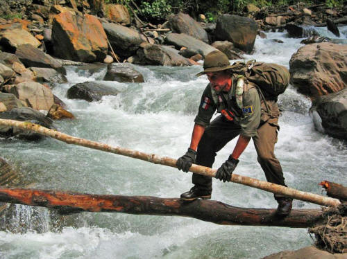
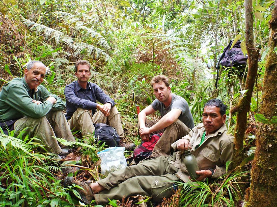
Thierry Jamin
during an expedition in the National Park of Manú,
a
delicate passage on an undiscovered river.
(Photo by Thierry Jamin)
After having climbed now upriver, up and out of the cloud
forest, to emerge back at the high alturas where we had begun,
we soon ran into some wandering vaqueros, cowboys, who had
driven the cattle to these lonely grasslands for unlimited
grazing.
From them we learned
of an enchanted lake shaped like a figure "8", astride ancient
ruins, in a perpetually rainy and cold area to the northwest.
Thanks to the
preternatural sense of direction of my long-term expedition
partner, Paulino Mamani, as well as my GPS and an aerial
photography generated map which showed such an unnamed lake in
the area we approached, we found it.
And here were a
series of low Incan platforms and retaining walls, which, along
with the remnants of Incan trail and retaining wall closer to
the Timpía, constitute the furthest Incan remains yet found
directly north of the Incan capital of Cusco.

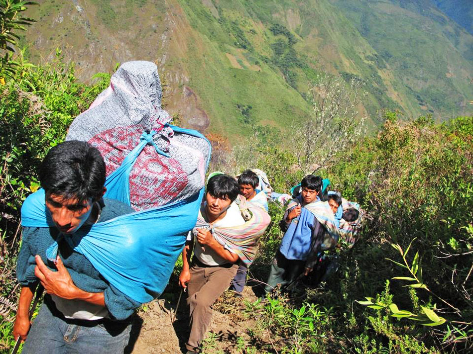
In
the valley of Lacco,
Thierry Jamin's expedition team transports supplies.
(Photo by Thierry Jamin)
It is here that an unnamed mountain range overlooks the Río
Yungaria, a tributary of the Callanga, in the tangled jungles
between the zone of Mameria to the north and that of Callanga to
the south.
I saw the beginnings
of this isolated tropical range in 1994, when, from the
confluence of the Río Yungaria and the Río Callanga, where
Paulino and I were searching for some gigantic terraces that Dr.
Neuenschwander had spotted years before from the air, I marveled
at how precipitously the territory behind the Yungaria soared
upward and away from the river, beyond sight.
Then in 1995, from a
high perch on the eastern edge of the Andes, as we were
ascending from the valley of the headwaters of the Callanga to
the highlands to the west, I caught a glimpse of the mighty
peaks of this strange massif, which seemed to reach to a height
quite uncommon for tropical mountains out beyond the Andes:
while the entire
range was enveloped in what appeared to be a thick mantle of
green vegetation, the actual peaks were shrouded in what
appeared to be perpetual cloud around the summits.
Adjacent areas, as
described by long-time Paititi seeker, Padre Juan Carlos
Polentini, are said to harbor the extensive ancient stone ruins
that could be the legendary Paititi."
NOTE: Some portions of
Greg Deyermenjian's writings have not been edited due to space
restrictions. Visit complete manuscript
here.
Even civilian
explorers like California based adventurer and photographer
Fernando S. Gallegos have been inspired to explore the
area.
His detailed and
fascinating account of reaching Pusharo, deep in the Amazonian
jungle after surviving tarantula swarms and being stranded in
torrential rains, shows exactly how arduous and dangerous the
journey is.
I asked Fernando
what compelled him to take such dangerous journeys and he explained:
"I want to
rekindle that forgotten sense of curiosity that we all seem to
lose when we enter adulthood.
The thought of
discovering some physical link to that part of our imagination
we deem as unrealistic or impossible is motivation enough to
reassure myself that perhaps some greater beyond all expectation
still exists out there waiting to be found."

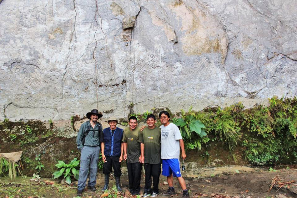
Explorer Fernando S. Gallegos
standing by the
Pusharo petroglyphs along with his
guides
(photo by Fernando Gallegos)
In my exclusive
interview with famed French explorer
Thierry
Jamin, I was able to get the most updated information as to the
next steps in discovering Paititi later this year.
What are your
plans for discovering the Lost City of Paititi this summer?
For about twenty
years, my team and I dedicated our searches on the tracks of the
permanent presence of the Incas in Amazonian forest. We looked for
their main center of population: the lost city of Paititi.
Since
1998, we have completed about twenty expeditions in the southeast of
Peru.
In 2009, we
ventured into a lost valley, North of Cusco:
the
valley of Lacco.
In Quechua, the
word "lacco" means "labyrinth", or "the place where we get lost".
Accompanied by
archaeologists from the Ministry of Culture, we were surprised to
discover numerous unknown archaeological sites of the modern
archaeology: fortresses, small centers of agricultural production,
several necropolises and complete cities populated with hundreds of
buildings.
These were real
"Pompeii Amazonians"! From 2009 till 2013, we continued to discover
more than forty complete sites.
Situated on
original Incan stone paths, these lost cities seem to lead to the
north of Cusco, towards the National Sanctuary of Megantoni. This
sanctuary shelters one of the most difficult to access forests in
South America. It is the cradle of the Matsiguengas Indians, with
whom we have a very good relationship.
Since 2010, several
Matsiguengas Indians told us about the existence of a strange
mountain, at the top of which would hide the ruins of an old stony
city: the legendary city of Paititi. During several years, we tried
to locate this mysterious mountain.
Then, in June,
2012, the French company Astrium helped us obtain a series
of satellite photos of exploration zone. In certain photos, we
localized a very strange mountain of square shape, one thousand
meters aside.
We would say a
cube, in the heart of the forest, encircled by abysms of a several
hundred meters deep.
A site apparently
very strategic, easy to defend and impossible to invade.
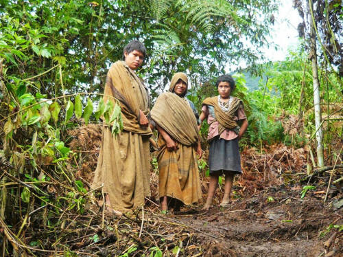
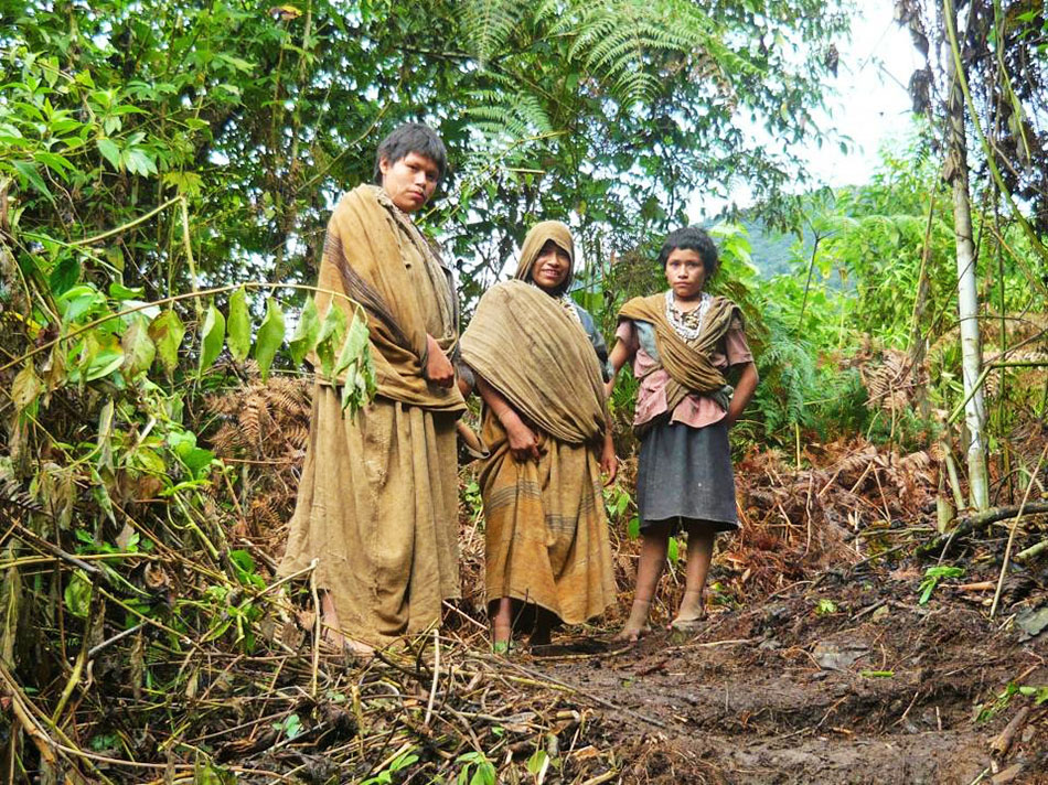
In the National
park of Manú,
three young
Matsiguengas women
of the native
community of Mameria.
© Photo : Thierry
Jamin
A hundred meters
west of this mountain, two twin lakes and a mysterious square lake,
seem to confirm the testimonies of the Matsiguengas.
All of the
legendary traditions assert that Paititi was built near such extents
of water.
We tried to reach
this mountain in 2011 in vain and then, in 2012, new discoveries in
Machu Picchu took away from our search for Paititi. But in 2013 and
2014, other expeditions allowed us to approach our goal of only a
few kilometers.
The jungle of
Megantoni is dangerous and very difficult to access, especially for
a team moving with important supplies. Our diverse expeditions have
not allowed us yet to reach the ruins of the lost city.
Nevertheless, the
Matsiguengas Indians are convinced: it is at the top of this "well
cut" mountain that hide the vestiges of the queen of the South
American lost cities.

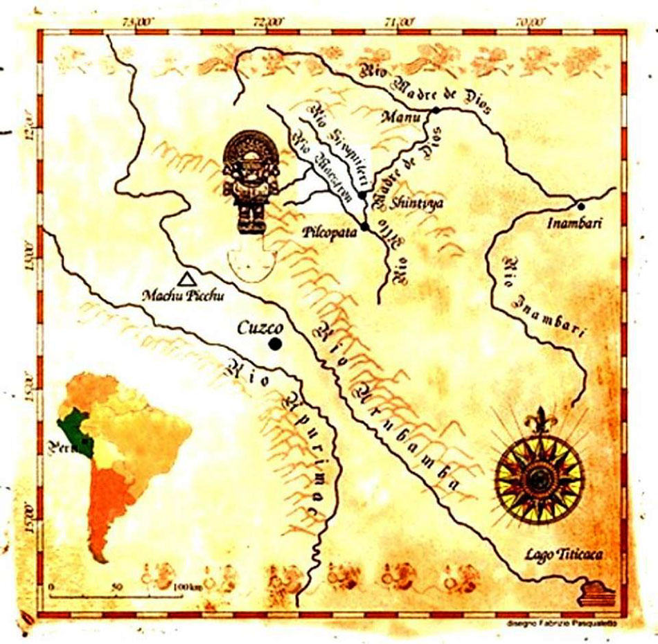
Ancient map
describing
location of the Secret City
Tell me
about your expedition to that area this year?
We have
prepared our next exploration with the objective of reaching the
"square mountain" and the lakes by helicopter.
After several
unfortunate attempts, we arrived at the conclusion that the
helicopter is the only way to reach this zone. If we manage to
finance this operation, the expedition will take place in July.
It should last three weeks.
We plan to
explore the mountain in great detail, but also the lakes, thanks
to the use of a ROV (automatic soumarin robot) and with
professional divers. Several professional archaeologists will
also participate in the operation.
The probability
to discover an important archaeological site, of the scale of
Machu Picchu, hidden at the top of this mysterious mountain is
very big.
I am convinced
that we shall soon experience the discovery of Paititi.
Critics
have commented that further exploration to these remote
indigenous communities will bring disease and cause harm. How do
you respond to their criticism?
Communities of
the uncontacted Kuga Pakuris Indians live in the Sanctuary of
Megantoni, but not in the area we are exploring, which is very
difficult to access.
These Indians
live in the hunting areas. The area of the "square mountain" is
surrounded by vertical walls of nearly a thousand meters high
and Kuga Pakuris never go to that area. We are in permanent
contact with Matsiguenga of Megantoni tribes, who participate in
our expeditions.
This area is
part of their territory, rather than the "uncontacted" tribes.
All of our
search campaigns are carried out within a legal framework, with
the permission and participation of Peruvian authorities
(Ministry of Culture and Ministry of Environment - SERNANP)

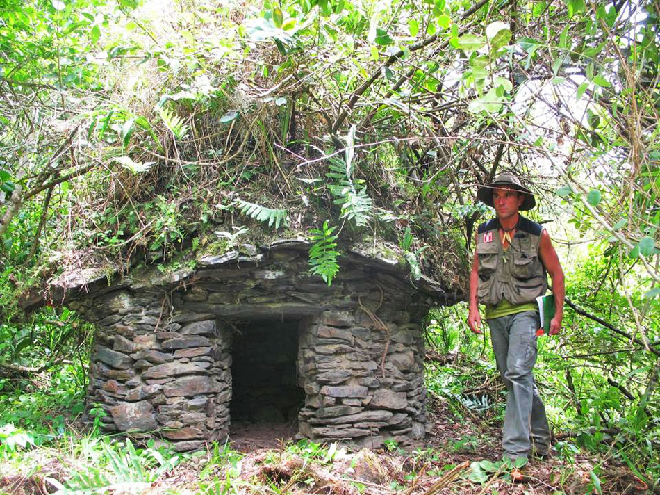
The French
explorer Thierry Jamin,
near a
chullpa, or funeral tower, in the Inca necropolis of Puccro,
valley of
Lacco.
© Photo
Thierry JAMIN, 2009.
Can't you just
fly over the area and use modern radar LIDAR technology rather
than disturbing the environment?
It would be
quite possible to use the radar technology, such as LIDAR.
But they are
still very expensive for us. And nothing beats field research.
The radars cannot perform the exploration in underwater lakes.
This is the essence of archaeological research.
On the ground,
we use modern technology: GPS, drones, ROV, endoscopic cameras,
scanners, etc. And this we can only do on the ground.
The purpose of
the operation "Paititi 2016" is to reach the famous "square
mountain" by air, with the use of a helicopter. We have never
tried that approach before. We want to spread the legend of
Paititi through science.
We need science
and professional archaeologists to reach the lost city BEFORE
the huaqueros or treasure hunters arrive.
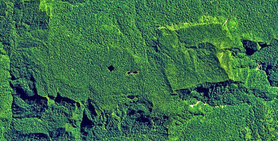
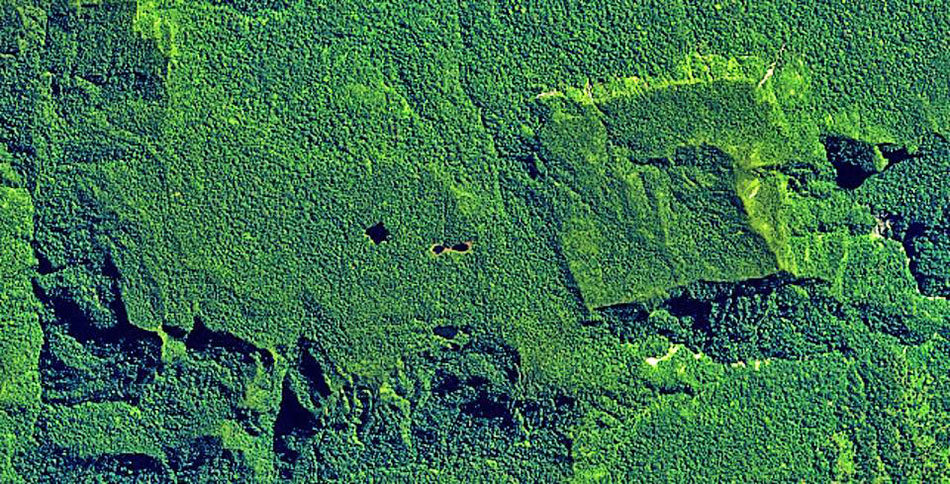
In the North
of the National Sanctuary of Megantoni,
the satellite
Pleiades located a strange quadrangular formation
of one
thousand meters near a mysterious square lake
and near twin
lakes. The Natives of the region
assure that
Paititi hides at the top of this mountain.
(Photo by
Astrium – CNES)
This is the
challenge of our research.
We know, for
example, that a Spanish team visited last September, near the
Sanctuary of Megantoni without any permit, in search of Paititi.
They are unfortunately not the only ones.
Our satellite
images of the "square mountain" were widely disseminated. Other
adventurers, unscrupulous, may try to reach the area
clandestinely in search of the legendary gold.
Science must
discover the site of Paititi first and return this great
historical and archaeological treasure to the hands of the World
Heritage Site.
This is the
challenge of our 2016 exploration."
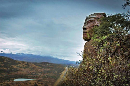
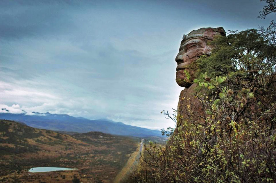
Rock face carving
by Indians
(Photo by
Fernando S. Gallegos)
THE HISTORY OF PAITITI EXPLORATIONS
1600:
Missionary Andres Lopez discovers Paititi and
writes to the Vatican about his findings.
1925:
Percy Harrison Fawcett, the inspiration for
"Indiana Jones" attempts first exploration to the area. The
archaeologist and South American explorer, along with his eldest
son disappeared under unknown circumstances during an expedition
to find "Z" – his name for the ancient lost city. Brad Pitt is
currently shooting the film "The Lost City of Z" about Fawcett's
adventure and life.
1954:
Hitler's photographer Hans Ertl discovered many
Pre-Columbian sites and claimed to have discovered Plato's
Atlantis in the Bolivian Altiplano. The Nazi propaganda
cinematographer exiled to Bolivia where he went on to shoot the
expedition documentary "Paititi".
1958:
Peruvian explorer Carlos Neuenschwander Landa led
multiple expeditions in search of Paititi. He discovered the
Inca stone path, located in the mountains of Paucartambo, and
was the first person to describe, document and disseminate
Hualla fortress located in the rural area of Calca. In his
expeditions he has concentrated on the plateau where he sought
the city of Paititi. He eventually wrote the book "Paititi
in the mists of History."
1970-2002:
Carlos Neuenschwander Landa organizes several
expeditions in the national park of Manú in search of the lost
city. They land by helicopter at the petroglyphs of Pusharo.
1971:
A French-American expedition led by Bob Nichols, Serge
Debru and Georges Puel travelled up
the Rio Pantiacolla from Shintuya in search of Paititi. The
party's guides left after a 30 day agreement expired, and though
the three continued on, they never returned. In 1972 Japanese
explorer Yoshiharu Sekino contacted Machiguenga Indians in the
area and confirmed that the expedition members had been killed
by Indians.
1979:
French-Peruvian couple Nicole and Herbert Cartagena
discover the ruins of Mameria. For the first time, researchers
discover inca ruins in Amazonia. This discovery constitutes the
first scientific proof of the presence of Paititi.
1984-2011: Various
expeditions led by Gregory Deyermenjian. These
included the documentation of Incan remains in Mameria, the
exploration and documentation of the petroglyphs at Pusharo,
exploration and documentation of Manu's Pyramids of Paratoari,
and others.
1997:
Norwegian biologist Lars Hafskjold set out to
discover the ancient tribe of Toromona, the origins of the
Paititi legend. He disappeared somewhere in the unexplored parts
of Bolivia and has never been found.
2001:
The Kota Mama II expedition led by John Blashford-Snell
located some significant ancient ruins in the jungle east of
Lake Titicaca in Bolivia which are believed to be identical to
those discovered earlier by Hans Ertl.
2001:
French explorer Thierry Jamin investigated the
site of Pantiacolla. The pyramids are in fact natural formations
but Jamin discovered several Inca artefacts in the same area.
2002:
Polish explorer Jacek Pałkiewicz undertook an
expedition under the patronage of the government of Peru
upstream on the Madre de Dios River in search of Paititi. He
eventually became famous for locating the source of the Amazon
River. He subsequently wrote several novels on his explorations
including El Dorado, Hunting the Legend.
2004:
"Quest for Paititi" exploration team of Gregory
Deyermenjian and Ignacio Mamani
discovered several important Inca ruins along branches of the
Inca Road of Stone at the peak known as Último Punto in the
northern part of the Pantiacolla region of Peru.
2005:
Thierry Jamin and French-Peruvian
Herbert Cartagena studied Pusharo petroglyphs and
discovered large geoglyphs in a valley nearby. They reportedly
found a "map" showing where Paititi might be located. Further
expeditions were set up in the following years.
2009-2011: Various
expeditions by Italian researcher Yuri Leveratto who
reached one of the Pyramids of Pantiacolla.
2009-2013:
Thierry Jamin and his group explores the valleys of
Lacco, Chunchusmayo and Cusirini, in the North of the department
of Cusco, on the tracks of Paititi. Accompanied by the Peruvian
Ministry of Culture, they bring to light forty archeological
sites, including Hualla Mocco, Torre Mocco, Lucma Cancha,
Llactapata, Apucatina, Pantipallana and Chaupichullo.
2011:
British expedition to investigate the Pyramids of Paratoari with
Kenneth Gawne, Lewis Knight, Ken Halfpenny, I. Gardiner
and Darwin Moscoso as part of the documentary
"The Secret of the Incas."
2014:
TV host Josh Gates and Gregory Deyermenjian
searched for Paititi while filming "Expedition Unknown"
for the Travel Channel. They were forced to return after running
out of supplies.
2015:
Paititi documentary directed by Michel Gomez,
for the Peruvian national channel Latina based on
Thierry Jamin's book "The Adventurer of the Lost City"
2016:
Thierry Jamin will fly with helicopter research
teams to further explore the newly discovered possible location
of Paititi.
Fernando Gallegos
along the
Amazon river in
search of Paititi
(Photo by
Fernando S. Gallegos)
Ancient "Lost City" Discovered in
Peru
- Official
Claims -
by Kelly Hearn
January 16,
2008
from
NationalGeographic Website
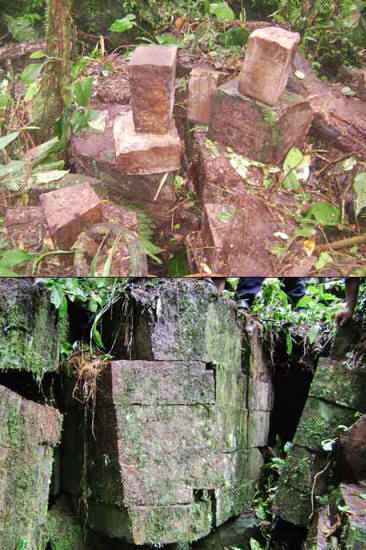
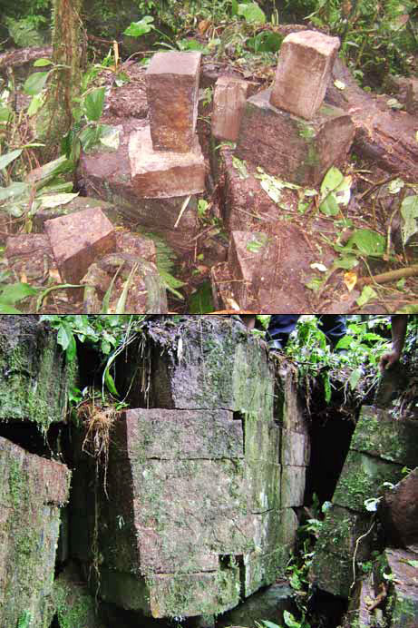
Cut stones (top) and masonry walls (bottom)
recently discovered in southern Peru
could be the ruins of the legendary "lost city" of Paititi,
according to the mayor of the town where the site were found.
Archaeologists are being sent to the site
to investigate the claim.
Source
Ruins recently discovered in southern Peru could be the ancient
"lost city" of Paititi, according to claims that are drawing serious
but cautious response from experts.
The presumptive lost city, described in written records as a stone
settlement adorned with gold statues, has long been a grail for
explorers - as well as a lure for local tourism businesses.
A commonly cited legend claims that Paititi was built by the Inca
hero
Inkarri, who founded the city of Cusco before retreating into
the jungle after Spanish conquerors arrived.
On January 10 Peru's state news agency reported that "an
archaeological fortress" had been discovered in the district of
Kimbiri and that the district's mayor suggested it was the lost
city.
Mayor Guillermo Torres described the ruins as a
430,000-square-foot (40,000-square-meter) fortification near an area
known as Lobo Tahuantinsuyo.
Few other details about the site were offered, but initial reports
described elaborately carved stone structures forming the base of a
set of walls.
The state media report quotes Torres as saying the area will be
"immediately declared" a cultural tourism site.
Officials from the Peruvian government's Cusco-based National
Institute of Culture (INC) met with Torres on Tuesday, according to
Francisco Solís, an INC official.
"It is far too early
to make any definitive judgments," Solís told National
Geographic News. "We are going to dispatch a team to
investigate."
Officials expect more
details to emerge in the coming days, he said.
Legend of Paititi
Paititi is believed to have been located somewhere east of the Andes
Mountains in the rain forest of southeastern Peru, southwestern
Brazil, or northern Bolivia.
In 1600 a missionary reported seeing a large "city of gold" in the
region where Paititi is believed to have been built, according to
archival records discovered by an Italian archaeologist in 2001.
However, the location of the newfound site falls counter to where
historical records indicate Paititi should be, Solís said.
Officials were nonetheless intrigued by the possibilities, he added.
The first task will be to determine if the newfound ruins are the
work of the Inca or pre-Inca ethnic groups, Solís said.
Gregory Deyermenjian, a U.S.-based psychologist and explorer who has
led many expeditions to investigate the Paititi legend, said many
people in the tourism-rich region of Cusco have embraced the legend
as a business promotion.
But he said the claims could have merit, as there are still many
important sites to be found.
"It is a bit off the
beaten path but still within the Inca's reach," Deyermenjian
said. "I'm very interested to know more."
Daniel Gade, professor
emeritus in geography at the University of Vermont, cautioned about
jumping to conclusions.
"Paititi is
frequently the first thing people mention when something like
this is found," Gade said, adding that there are many ruins in
the jungle regions of the area.
|