|


from
FreeMedia Website
 Within
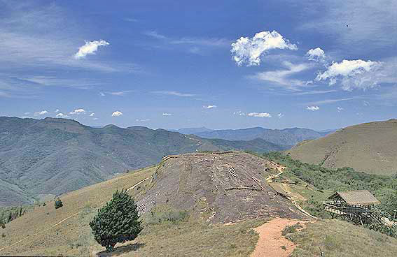
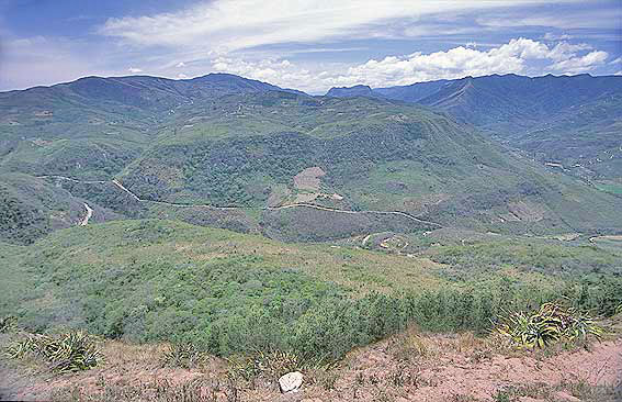
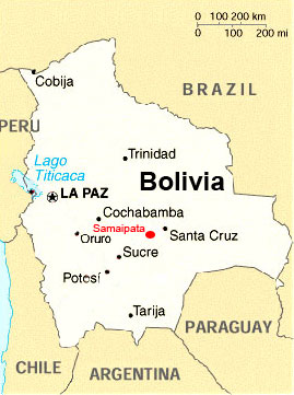
the eastern foothills of the Andes in Bolivia there lays in a height
of about 1900 m the ruined site "El Fuerte" (coordinates 18° 10'
30'' South and 63° 49' 10'' West), about 6 km far away from the
small town Samaipata situated at the old secondary road connecting
Cochabamba and Santa Cruz. Within
the eastern foothills of the Andes in Bolivia there lays in a height
of about 1900 m the ruined site "El Fuerte" (coordinates 18° 10'
30'' South and 63° 49' 10'' West), about 6 km far away from the
small town Samaipata situated at the old secondary road connecting
Cochabamba and Santa Cruz.
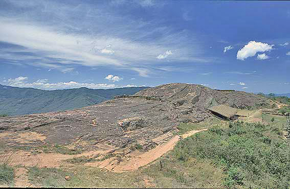
The complex about 40 hectares in size was appointed as "World
Heritage" to the World Heritage List by
the UNESCO World Heritage Committee at its session held at December
2nd 1998 in Kyoto/Japan.
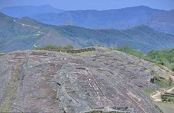
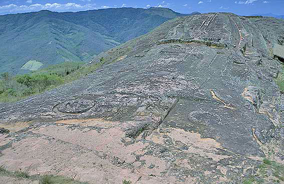
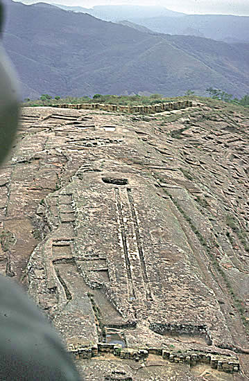
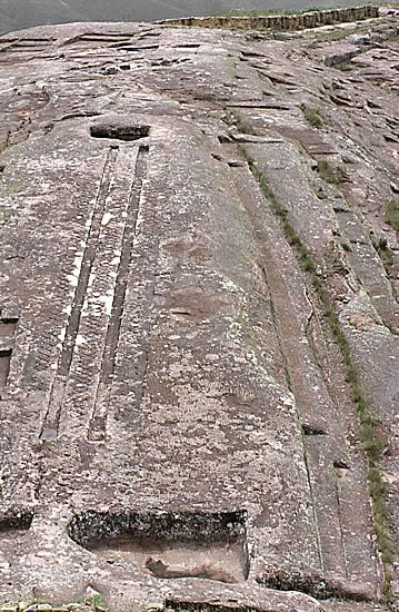
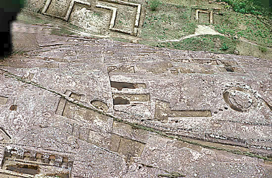
A first comprehending description of the sand stone rock, in which a
wealth of figures, grooves, channels, basins, steps, seats and
similar other things are engraved, as well as a depiction of the
most important elements was given by the French explorer Alcide
D'Orbigny in 1832.
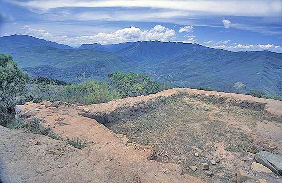
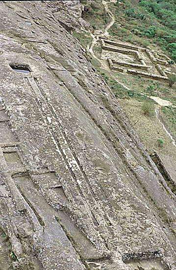
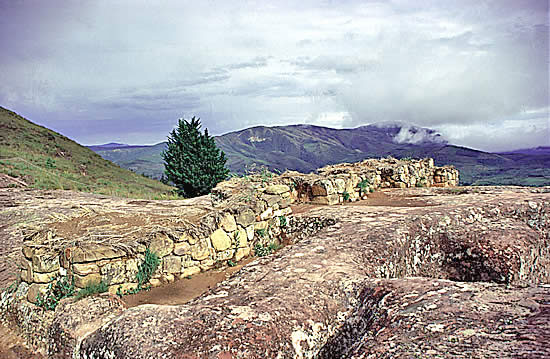
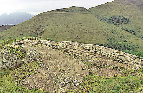
This archaeological site consists of two elements. The hill with its
great number of engravings and sculptures may have been the
ceremonial centre of the old city (14. - 16. century), whereas the
area south beyond the hill was the administration and residential
area.
The modeled hill raising dominantly above the residential
area demonstrates a unique proof of Pre-Columbian culture at the
American continent.
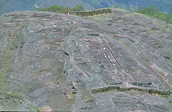
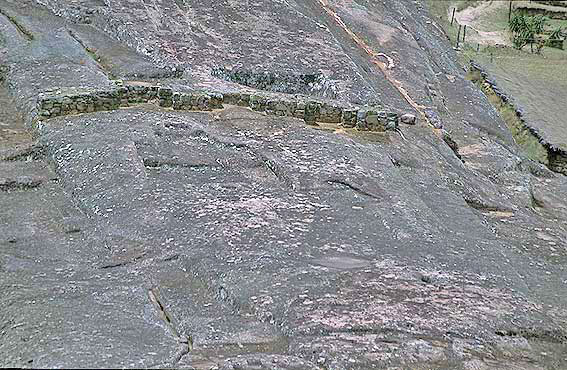
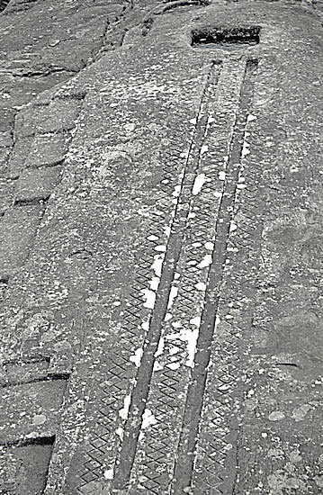
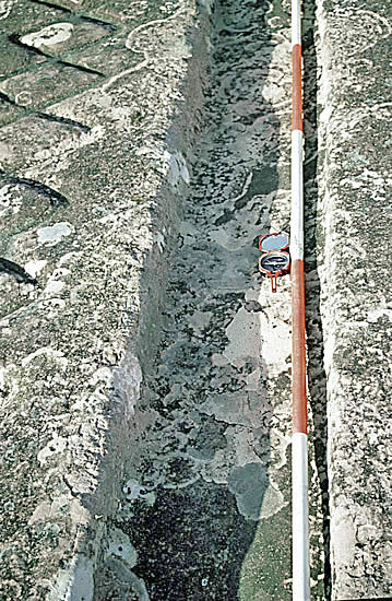
In particular striking are the two parallel channels rising within
the rocks exactly from east to west and being flanked by engraved
rhomboid bands.
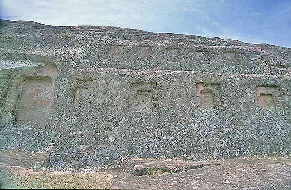
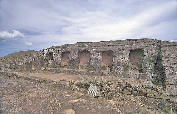
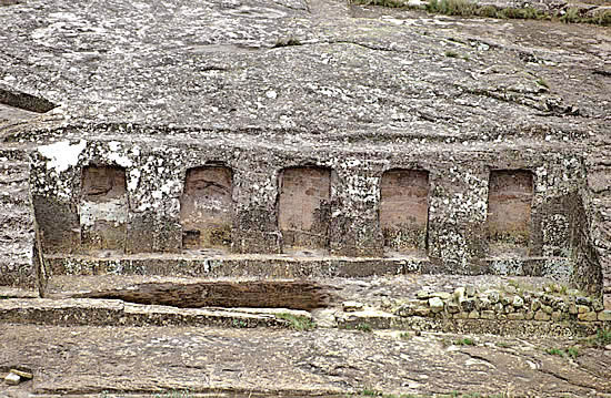
At the flanks of the rocks, in the north once only,
in the south over a length of about 200 m, there are niches of human
size carved into the front of the stones showing each the
longitudinal wall of a temple.
This complex is a ceremonial site of
the Inca and the remains of
former settlements from the highland cultures and those of the
eastern lowlands.
After the destruction of the Inca temples the
Spanish conquerors built a patio house at the ruins as a
fortification against the lowland Indians (Chiriguano).
Probably the
name "El Fuerte" is coming from this time.
|