|

by Mark Sircus
Director
03 October 2012
from
IMVA Website
Spanish version
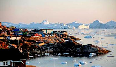
In January of 2011 I was knocked off my chair with the report from
the Arctic Circle in Greenland that the sun came back over the
horizon two days early.
That’s no small occurrence, is not
something easy to make up, was not reported in the mainstream press,
and only wild and stupid theories like global warming were being
blamed for the event.
Now almost two years later we see that scientists have developed a
computer model to identify four possible instances of true polar
wander in the past. And, they say,
true polar wander is happening now.
That would explain this more than bizarre event in Greenland and the
fact that Indian elders have been communicating about unprecedented
changes in the Arctic Circle for the last few years.
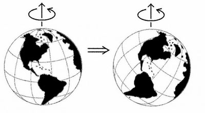
True polar wander is a geophysical theory that suggests that if an
object of sufficient weight on Earth - for example, a supersized
volcano or other weighty land mass - formed far from Earth’s
equator, the force of Earth’s rotation would gradually pull the
object away from the axis around which Earth spins.
A supersized volcano far from Earth’s
equator would create an imbalance, in other words.
As explained at Princeton.edu:
If the volcanoes, land and other
masses that exist within the spinning Earth ever became
sufficiently imbalanced, the planet would tilt and rotate itself
until this extra weight was relocated to a point along the
equator.
Earth Changes
We have many things threatening us these days, not the least of
which is the weather above ground and the weather (earthquake
activity) below ground.
I have been following the reports from
around the world that indicate that things are shifting quickly in
terms of weather, natural disasters, strange happenings, solar
activity and the like.
Earthquakes and volcanic activity seem
to be increasing dramatically as the last few weeks have shown.
The U.S. Geological Survey reports that early Tuesday morning local
time, a magnitude 6.2 earthquake hit off of Japan’s eastern coast.
Originating from a depth of 9.7 kilometers (6 miles), it was
centered about 96 kilometers (60 miles) off the coast of Miyako,
Iwate Prefecture, in the northeast region of the country that was
struck by the
devastating earthquake and tsunami
on March 11th, 2011.
The quake probably gave some frightful
flashbacks to those of Japan’s Tohoku region who survived last
year’s disaster.
The tsunami disaster that took tens of
thousands of lives and washed away entire coastal cities was caused
by a magnitude 9.0 earthquake just over a year and a half ago and
led to the world’s worst nuclear crisis in 25 years in Fukushima
Prefecture.
Another tidal wave and it could be toast
for the northern hemisphere if Fukushima gets completely destroyed.
On September 30, 2012 a strong 7.3 magnitude earthquake struck along
the coast of Colombia at a depth of 162.1 km (100.7 miles). The
epicenter of the earthquake was 62 km (39 miles) S (176°) from
Popayan, Colombia and 345 km (214 miles) from QUITO, Ecuador.
According to USGS statistics, about 15
earthquakes of magnitude 7.0 occur each year but there have been
five such high-intensity earthquakes reported across the planet
in the last 45 days...
|