|
August 30, 2013 from EarthSky Website
a 460 Mile Long Canyon has Been Discovered
Below Greenland’s Ice Sheet.
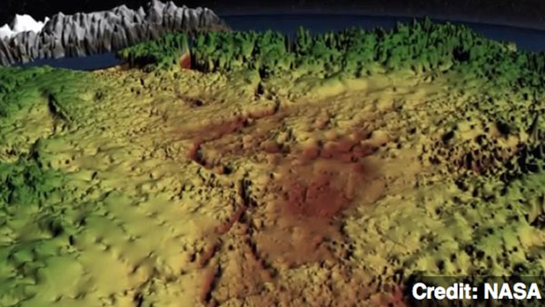
Data from a NASA airborne science mission has revealed an immense and previously unknown canyon hidden under a mile of Greenland ice.
The canyon has the characteristics of a winding river channel and is at least 460 miles (750 kilometers) long, making it longer than the Grand Canyon. In some places, it is as deep as 2,600 feet (800 meters), on scale with segments of the Grand Canyon.
This immense feature is thought to predate the ice sheet that has covered Greenland for the last few million years.
The scientists used thousands of miles of airborne radar data, collected by NASA and researchers from the United Kingdom and Germany over several decades, to piece together the landscape lying beneath the Greenland ice sheet.
a 460 mile long canyon has been discovered below Greenland’s ice sheet. Using radar data from NASA’s Operation IceBridge, scientists found the canyon runs from near the center of the island northward to the fjord of the Petermann Glacier.
Image credit: NASA
One of IceBridge’s scientific
instruments, the Multichannel Coherent Radar Depth Sounder, can see
through vast layers of ice to measure its thickness and the shape of
bedrock below.
The longer it took, the deeper the bedrock feature.
The researchers believe the canyon plays an important role in transporting sub-glacial meltwater from the interior of Greenland to the edge of the ice sheet into the ocean.
Evidence suggests that before the presence of the ice sheet, as much as 4 million years ago, water flowed in the canyon from the interior to the coast and was a major river system.
The IceBridge campaign will return to
Greenland in March 2014 to continue collecting data on land and sea
ice in the Arctic using a suite of instruments that includes
ice-penetrating radar.
|