|
The Elusive Mount
Somewhere in the Sinai peninsula, the Nefilim had established their
postDiluvial Spaceport. Somewhere in the Sinai peninsula, mortals—a
select few, with their God 's blessing—could approach a certain
mountain.
There,
"Go back!" the guarding birdmen ordered Alexander,
"for the land on which you stand belongs to God, alone."
There,
"Do
not come nearer!" the Lord called out to Moses, "for the place
whereon thou standest is sacred ground."
There, eaglemen challenged
Gilgamesh with their stunrays, only to realize he was no mere
mortal.
The Sumerians called this mount of encounter Mount MA.SHU—the Mount
of the Supreme Barge. The tales of Alexander named it Mount Mushas—the
Mountain of Moses. Its identical nature and function, coupled with
its identical name, suggest that in all instances it was the same
mountain that was the destination's landmark. It thus seems that the
answer to the question "Where in the peninsula was the gateway?" is
right at hand: Is not the Mount of the Exodus, "Mount Sinai,"
clearly marked on maps of the peninsula—the tallest peak among the
high granite mountains of southern Sinai?
The Israelite Exodus from Egypt has been commemorated each year for
the past thirty-three centuries by the celebration of the Passover.
The historical and religious records of the Hebrews are replete with
references to the Exodus, the wanderings in the Wilderness, the
Covenant at Mount Sinai. The people have been constantly reminded of
the Theophany, when the whole nation of Israel had seen
the Lord
Yahweh alight in his glory upon the sacred mount.
Yet its location
was deemphasized, lest attempts be made to make the place a cult
center. There is no recorded instance in the Bible of anyone even
trying to pay a return visit to Mount Sinai, with one exception: the
Prophet Elijah. Some four centuries after the Exodus, he escaped for
his life after having slain the priests of Ba'al upon Mount Carmel.
Setting his course to the mount in Sinai, he lost his way in the
desert. An angel of the Lord revived him and placed him in a cave in
the mount.
Nowadays, it would seem, one needs no guiding angel to find Mount
Sinai. The modern pilgrim, as pilgrims have done for centuries past,
sets his course to the monastery of Santa Katarina (Fig113), so
named after the martyred Katherine of Egypt whose body angels
carried to the nearby peak bearing her name.
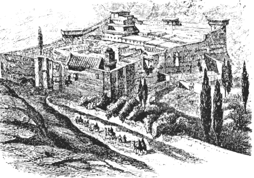
Fig113
After an overnight
stay, at daybreak, the pilgrims begin the climb to Gebel Mussa
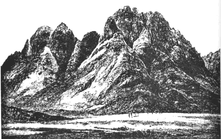
("Mount Moses" in Arabic). It is the southern peak of a two mile
massif rising south of the monastery—the "traditional" Mount Sinai
with which the Theophany and the Lawgiving are associated (Fig.
114).

Fig. 114
The climb to that peak is long and difficult, involving an ascent of
some 2,500 feet. One path is by way of some 4,000 steps laid out by
the monks along the western slopes of the massif. An easier way that
takes several hours longer begins in the valley between the massif
and a mountain appropriately named after Jethro, the fatherinlaw
of Moses, and rises gradually along the eastern slopes until it
connects with the last 750 steps of the first path. It was at that
intersection, according to the monk's tradition, that Elijah
encountered the Lord.
A Christian chapel and a Muslim shrine, both small and crudely
built, mark the spot where the Tablets of the Law were given to
Moses. A cave nearby is revered as the "cleft in the rock" wherein
the Lord placed Moses as He passed by him, as related in Exodus
33:22. A well along the descent route is identified as the well from
which Moses watered the flock of his fatherinlaw. Every possible
event relating to the Holy Mount is thus assigned by the monks'
traditions a definite spot on the peak of Gebel Mussa and its
surroundings.
From the peak of Gebel Mussa, one can see some of the other peaks
which make up the granite heartland, of which this mount is a
member. Surprisingly, it appears to be lower than many of its
neighbors!
Indeed, in support of the Saint Katherine legend, the monks have put
up a sign in the main building which proclaims:
Altitude 5012 FT
Moses Mount 7560 FT
Sta. Katherine Mount 8576 FT
As one is convinced that Mount Katherine is indeed the higher one—in
fact, the highest in the peninsula—and thus rightly chosen by the
angels to hide the saint's body thereon, one is also disappointed
that—contrary to longheld beliefs—God had brought the Children of
Israel to this forbidding area, to impress upon them his might and
his laws not from the tallest mount around.
Had God missed the right mountain?
In 1809, the Swiss scholar Johann Ludwig Burckhardt arrived in the
Near East in behalf of the British Association for Promoting the
Discovery of the Interior Parts of Africa. Studying Arabic and
Muslim customs, he put a turban on his head, dressed as an Arab and
changed his name to Ibrahim Ibn Abd Allah—Abraham the Son of Allah's
Servant. He was thus able to travel in parts hitherto forbidden to
the infidels, discovering ancient Egyptian temples at Abu Simbel and
the Nabatean rock city of Petra in Transjordan.
On April 15, 1816, he set out on camelback from the town of Suez, at
the head of the Gulf of Suez. His goal was to retrace the route of
the Exodus, and thereby to establish the true identity of Mount
Sinai. Following the
presumed route taken by the Israelites, he traveled south along the
western coast of the peninsula. There the mountains begin some ten
to twenty miles away from the coast, creating a desolate coastal
plain cut here and there by wadis and a couple of hot springs,
including one favored by the Pharaohs.
As he went south, Burckhardt noted the geography, topography,
distances. He compared conditions and place names with the
descriptions and names of the stations of the Exodus as mentioned in
the Bible. Where the limestone plateau ends, nature has provided a
sandy belt which separates the plateau from a belt of Nubian
sandstone, serving as a crossSinai avenue. There Burckhardt turned
inland, and after a while set his course southward into the granite
heartland, reaching the Katherine monastery from the north (as
today's air traveler does).
Some of his observations are of a lingering interest. The area, he
found, produced excellent dates; the monks had a tradition of
sending large boxes of them as an annual tribute to the sultan in
Constantinople. Befriending the area's Bedouins, they invited him to
the annual feast in honor of "St. George"; they called him "El
Khidher"—The Evergreen!
Burckhardt ascended mounts Mussa and Katherine and toured the area
extensively. He was especially fascinated by Mount Umm Shutnar—a
mere 180 feet shorter than Mount St. Katherine—which rises somewhat
southwest of the MussaKatherine group. From a distance, its top
dazzled in the sun "with the most brilliant white color," due to an
unusual inclusion of particles of mica in the granite rocks, forming
"a striking contrast with the blackened surface of the slate and the
red granite" of the mountain's lower parts and the surrounding area.
The peak also had the distinction of
offering an unobstructed view to both the Gulf of Suez ("elTor was distinctly visible") and the
Gulf of Aqaba (Gulf of Elat). Burckhardt found it mentioned in the
convent's records, that Umm Shumar used to be a principal location
of monastic settlements. In the fifteenth century, "caravans of
asses laden with corn and other provisions passed by this place
regularly from the convent to elTor, for this is the nearest road
to that harbor."
His way back was via Wadi Feiran and its oasis—the largest in Sinai.
Where the wadi leaves the mountains and reaches the coastal strip,
Burckhardt climbed up a magnificent mountain rising over 6,800 feet—
Mount Serbal, one of the tallest in the peninsula. There he found
remains of shrines and pilgrims' inscriptions. Additional research
established that the main monastic center in Sinai, through most of
the centuries, was at Wadi Feiran, near Serbal—and not at St.
Katherine.
When Burckhardt published his findings (Travels in Syria and the
Holy Land), his conclusions shook the scholarly and biblical world.
The true Mount Sinai, he stated, was not Mount Mussa, but Mount Serbal!
Inspired by Burckhardt's writings, the French Count Leon de Laborde
toured the Sinai in 1826 and 1828; his main contribution to the
knowledge of the area (Commentaire sur L'Exode) were his fine maps
and drawings.
He was followed in 1839 by the Scottish artist David Roberts; his
magnificent drawings, wherein he embellished accuracy with some
imaginative flair, aroused great interest in an era before
photography.
The next major journey to Sinai was undertaken by the American
Edward Robinson, together with Eli Smith. Like Burckhardt, they left
Suez City on camelback, armed with his book and de Laborde's maps.
It took them thirteen early spring days to reach St. Katherine.
There, Robinson gave the monks' legends a thoroughgoing examination.
He found out that at Feiran there indeed was a superior monastic
community, sometimes led by full bishops, to which Katherine and
several other monastic communities in southern Sinai were
subordinate; so that tradition must have placed greater emphasis on
Feiran. In the tales and documents, he discovered that mounts Mussa
and Katherine were of no Christian consequence in the early
Christian centuries, and that Katherine's supremacy developed only
in the seventeenth century, when the other unfortified monastic
communities fell prey to invaders and marauders.
Checking local Arab
traditions, he found that the biblical names "Sinai" and "Horeb"
were totally unknown to the local Bedouins; it was the Katherine
monks who began to apply these names to certain mountains.
Was Burckhardt, then, right? Robinson (Biblical Researches in
Palestine, Mount Sinai and Arabia Petraea) found a problem with the
route by which Burckhardt had the Israelites reach Serbal, and
therefore refrained from endorsing the new idea; but he shared the
doubts regarding Mount Mussa, and pointed at another nearby mountain
as a better choice.
The possibility that the longheld tradition identifying Mount Sinai
with Mount Mussa was incorrect was a challenge that the great
Egyptologist and founder of scientific archaeology, Karl Richard Lepsius, could not resist. He crossed the Gulf of Suez by boat,
landing at elTor ("The Bull")—the harbor town where Christian
pilgrims to St. Katherine and Mount Moses used to land even before
the Muslims made it a major stopover and decontamination center on
the sea route from Egypt to Mecca. Nearby rose the majestic Mount UmmShumar, which Lepsius on and off compared as a "candidate" with
Mussa and Serbal. But after extensive research and area touring, he
focused on the burning problem of that day: Mussa or Serbal?
His findings were published in Discoveries in Egypt, Ethiopia and
the Peninsula of Sinai 1842-1845 and Letters from Egypt,
Ethiopia and Sinai, the latter including (in translation from German), the
full text of his reports to the king of Prussia, under whose
patronage he traveled. Lepsius voiced doubts regarding Mount Mussa
almost as soon as he reached the area:
"The remoteness of that
district, its distance from frequented roads of communication and
its position in the lofty range," he wrote, "... rendered it
peculiarly applicable for individual hermits; but for the same
reason inapplicable for a large people."
He felt certain that the
hundreds of thousands of Israelites could not have subsisted among
the desolate granite peaks of Mount Mussa for the long (almost a
year) Israelite stay at Mount
Sinai. The monastic traditions, he confirmed, dated to the sixth
century
A.D. at the earliest; they could therefore serve as no guide in this
quest.
Mount Sinai, he stressed, was in a desert plain; it was also called
in the Scriptures Mount Horeb, the Mount of the Dryness. Mussa was
amidst other mountains and not in a desert area. On the other hand,
the coastal plain in front of Mount Serbal was such an area—large
enough to hold the Israelite multitudes as they viewed the
Theophany; and the adjoining Wadi Feiran was the only place that
could sustain them and their cattle for a year.
Moreover, only
possession of "this unique fertile valley" could have justified the Amalekite attack (at Rephidim, a gateway place near Mount Sinai);
there was no such fertile place, worth fighting for, near Mount
Mussa. Moses first came to the mount in search of grazing for his
flock; this he could find at Feiran, but not at the desolate Mount
Mussa.
But if not Mount Mussa, why Mount Serbal? Besides its "correct"
location at Wadi Feiran, Lepsius found some concrete evidence.
Describing the mount in glowing terms, he reported finding on its
top "A deep mountain hollow, around which the five summits of Serbal
unite in a half circle and form a towering crown."
In the middle of
this hollow he found ruins of an old convent. It was at that
hallowed spot, he suggested, that the "Glory of the Lord" had
landed, in full view of the Israelites (who were gathered in the
plain to the west). As to the fault that Robinson had found with Burckhardt's Exodus route to Serbal—Lepsius offered an alternative
detour which corrected the problem.
When the conclusions of the prestigious Lepsius were published, they
shook tradition in two ways: he emphatically denied the
identification of Mount Sinai with Mount Mussa, voting for Serbal;
and he challenged the Exodus route previously taken for granted.
The debate that followed raged for almost a quarter of a century and
produced discourses by other researchers, notably Charles Foster
(The Historical Geography of Arabia; Israel in the Wilderness) and
William H. Bartlett (Forty Days in the Desert on the Track of the
Israelites). They added suggestions, confirmations and doubts. In
1868 the British government joined the Palestine Exploration Fund
in sending a fullscale expedition to Sinai.
Its mission, in
addition to extensive geodesic and mapping work, was to establish
once and for all the route of the Exodus and the location of Mount
Sinai. The group was led by captains Charles W. Wilson and Henry
Spencer Palmer of the Royal Engineers; it included Professor Edward
Henry Palmer, a noted Orientalist and Arabist. The expedition's
official report (Ordnance Survey of the Peninsula of Sinai) was
enlarged upon by the two Palmers, in separate works.
Previous researchers went to the Sinai for brief tours mostly in
springtime. The WilsonPalmer expedition departed from Suez on November 11, 1868, and returned to Egypt on April 24, 1869—staying
in the peninsula from the beginning of winter until the following
spring. Thus, one of its first discoveries was that the mountainous
south gets very cold in
winter and that it snows there, making passage difficult, if not
impossible. The higher peaks, such as Mussa and Katherine, remain
snowcovered for many winter months. The Israelites—who had never
seen snow in Egypt— had stayed a year in this area. Yet there is no
mention at all in the Bible of either snow or even cold weather.
While Captain Palmer (Sinai: Ancient History from the Monuments)
provided data on the archaeological and historical evidence
uncovered (early habitations, Egyptian presence, inscriptions in the
first known alphabet), it was the task of Professor E. H. Palmer
(The Desert of the Exodus) to outline the group's conclusions
regarding the route and the mount.
In spite of lingering doubts, the group vetoed Serbal and voted for
the Mount Mussa location, but with a twist. Since in front of Mount
Mussa there was no valley wide enough where the Israelites could
encamp and see the Theophany, Palmer offered a solution: The correct
Mount Sinai was not the southern peak of the massif (Gebel Mussa),
but its northern peak, RasSufsafeh, which faces "the spacious plain
of ErRahah where no less than two million Israelites could encamp."
In spite of the longheld tradition, he concluded, "we are compelled
to reject" Gebel Mussa as the Mount of the Lawgiving.
The views of Professor Palmer were soon criticized, supported or
modified by other scholars. Before long, there were several southern
peaks that were offered as the true Mount Sinai, as well as several
different routes to choose from.
But was the southern Sinai the only place in which to search?
Back in April 1860, the Journal of Sacred Literature published a
revolutionary suggestion, that the Holy Mount was not in southern
Sinai at all, but should be looked for in the central plateau. The
anonymous contributor pointed out that its name, Badiyeth elTih, was
very significant: it meant "the Wilderness of the Wandering," and
the local Bedouins explain that it was there that the Children of
Israel wandered. The article suggested a certain peak of the elTih as the proper Mount Sinai.
So, in 1873, a geographer and linguist named Charles T. Beke (who
explored and mapped the origins of the Nile) set out "in search of
the true Mount Sinai." His research established that Mount Mussa was
so named after a fourth century monk Mussa who was famed for his
piety and miracles, and not after the biblical Moses; and that the
claims for Mount Mussa were begun only circa A.D. 550.
He also
pointed out that the Jewish historian
Josephus Flavius (who recorded
his people's history for the Romans after the fall of Jerusalem in
A.D. 70) described Mount Sinai as the highest in its area, which
ruled out both Mussa and Serbal.
Beke also asked, how could the Israelites have gone south at all,
past the Egyptian garrisons in the mining areas? His question has
remained one of the unanswered objections to a southern location of
Mount Sinai.
Charles Beke will not be remembered as the man who finally found the
true Mount Sinai: as the title of his work indicated (Discoveries of
Sinai in Arabia and Midian), he concluded that the mount was a
volcano, somewhere southeast of the Dead Sea. But he raised many
questions which cleared the desk for fresh and unfettered thinking
regarding the location of the mount and the route of the Exodus.
The search for Mount Sinai in the southern part of the peninsula was
closely linked with the notion of the "Southern Crossing" and
"Southern Route" of the Exodus. These held that the Children of
Israel literally crossed the Red Sea (from west to east) at or
through the head of the Gulf of Suez. Once across, they were out of
Egypt and on the western shores of the Sinai peninsula. They then
journeyed south along the coastal strip, turned (somewhere) inland,
and reached Mount Sinai (as, say, Burckhardt had done).
The Southern Crossing was indeed a deep-rooted and plausible
tradition, buttressed by several legends. According to Greek
sources, Alexander the Great was told that the Israelites had
crossed the Red Sea at the head of the Gulf of Suez; it was there
that he tried to emulate the Crossing.
The next great conqueror known to have attempted the feat was
Napoleon, in 1799. His engineers established that where the head of
the Gulf of Suez sends a "tongue" inland, south of where Suez City
is located, there exists an underwater ridge, some 600 feet wide,
which extends from coast to coast. Daredevil natives cross there at
ebb tide, with the waters up to their shoulders. And if a strong
east wind blows, the seabed is almost cleared of all water.
Napoleon's engineers worked out for their emperor the right place
and time for emulating the Children of Israel. But an unexpected
change in the wind's direction brought a sudden onrush of waters,
covering the ridge with more than seven feet of water within
minutes. The great Napoleon escaped with his life in the nick of
time.
These experiences only served to convince nineteenth century
scholars that it was indeed at that end of the Gulf of Suez that the
miraculous Crossing had taken place: a wind could create a dry path,
and a change in wind could indeed sink an army soon thereafter. On
the opposite, Sinai, side of the Gulf, there was a place named Gebel
Murr ("The Bitter Mountain") and near it Bir Murr ("The Bitter
Well"), invitingly fitting as Marah, the place of bitter waters,
encountered by the Israelites after the Crossing.
Further south lay
the oasis of Ayun Mussa—"The Spring of Moses"; now was not this the
next station, Elim, remembered for its beautiful springs and
numerous date palms? The Southern Crossing thus seemed to fit well
with the Southern Route theory, no matter where the turn inland had
taken place further on.
The Southern Crossing also agreed with the then current notions
regarding Egypt in antiquity and the Israelite bondage therein.
Egypt's historical heart was the Heliopolis-Memphis hub, and it was
assumed that
the Israelites slaved in the construction of the nearby pyramids of Gizeh. From there, a route led almost straight east, toward the head
of the Gulf of Suez and the Sinai peninsula beyond it.
But as archaeological discoveries began to fill in the historical
picture and provide an accurate chronology, it was established that
the great pyramids were built some fifteen centuries before the
Exodus—more than a thousand years before the Hebrews even came to
Egypt. The Israelites, more and more scholars agreed, must have
toiled in the construction of a new capital which the Pharaoh Ramses
II had built circa 1260 B.C. It was named Tanis and it was located
in the northeastern part of the Delta. The Israelite abode—the land
of Goshen—was consequently presumed to have been in the northeast
rather near the center of Egypt.
The construction of the Suez Canal (1859-1869), which was
accompanied by the accumulation of topographical, geological,
climatic and other data, confirmed the existence of a natural rift
which in an earlier geological age may have joined the Mediterranean
Sea in the north with the Gulf of Suez in the south. That link had
shrunk for various reasons, leaving behind a watery chain consisting
of the marshy lagoons of Lake Manzaleh, the small lakes Ballah and
Timsah, and the joined Great and Little Bitter Lakes. All these
lakes may have been larger at the time of the Exodus, when the head
of the Gulf of Suez probably extended farther inland.
Archaeological work complementing the engineering data also
established that there existed in antiquity two "Suez Canals," one
connecting Egypt's hub with the Mediterranean and the other to the
Gulf of Suez. Following natural wadi beds or dried up branches of
the Nile, they carried "sweet" water for drinking and irrigation and
were navigable. The finds confirmed that in earlier times there was
indeed an almost continuous water barrier which served as Egypt's
eastern border.
The engineers of the Suez Canal prepared in 1867 the following
diagram (Fig. 116) of a northsouth section of the Isthmus,
identifying four ridges of high ground which must have served in
antiquity, as they still do, the gateways to and from Egypt through
the watery barrier (Fig. 115):
Fig.115
(A)
Between the marshy lagoons of Manzaleh and Lake Ballah—the modern
crossing town of el-Qantara ("The Span").
(B)
Between Lake Ballah and Lake Timsah—the modern crossing point of
Ismailiya.
(C)
Between Lake Timsah and the Great Bitter Lake—a ridge known in
GreekRoman times as the Serapeum.
(D)
Between the Little Bitter Lake and the head of the Gulf of Suez—a
"landbridge" known as The Shalouf.

Fig.116
Through these Gateways, a number
of Routes connected Egypt with Asia via the Sinai peninsula. One has
to bear in mind that the crossing of the Red Sea (or Sea/Lake of Reeds) was not premeditated: it took place only
after the Pharaoh changed his mind about letting the Israelites go;
whereupon the Lord commanded them to turn back from the edge of the
desert which they had already reached, and "encamp by the sea."
Therefore, they originally exited from Egypt by one of the usual
gateways; but which one?
DeLesseps, the Canal's master builder, voiced the opinion that they
used Gateway "C," south of Lake Timsah. Others, like Olivier Ritter
(Histoire de l'Isthme de Suez), concluded from the exact same data
that it was Gateway "D." In 1874, the Egyptologist Heinrich Karl Rrugsch, addressing the
International Congress of Orientalists,
identified the landmarks connected with the Israelite enslavement
and Exodus in the northeastern corner of Egypt. Therefore, he said,
the logical gateway was all the way north— Gateway "A."
As it turned out, such a theory of a Northern Crossing was nearly a
century old when Brugsch launched it, having been suggested in
Hamelneld's Biblical Geography back in 1796, and by various
researchers thereafter. But Brugsch, as even his adversaries
conceded, presented the theory with a "really brilliant and dazzling
array of claimed corroboratory evidence from the Egyptian
monuments." His paper was published the following year under the
title L'Exode et les Monuments Egyptiens.
In 1883, Edouard H. Naville (The Store City of Pithom and the Route
of the Exodus) identified Pithom, the Israelite slavelabor city, at
a site west of Lake Timsah. This and other identifications and
evidence offered by others (such as by George Ebers in Durch Gosen
zum Sinai) established that the Israelite abode extended from Lake Timsah westward, not northward. Goshen was not in the extreme
northeast of Egypt, but adjoined the center of the watery barrier.
H. Clay Trumbull (Kadesh Barnea) then offered what has since been
generally accepted as the correct identification for Succoth, the
starting point of the Exodus: it was a common caravan gathering
place west of Lake Timsah, and Gateway "B" was the nearest at hand.
But it was not taken, as stated in Exodus 13:1718:
"And it came to
pass, when Pharaoh let the people go, that the Lord did not lead
them the Way of the Land of the Philistines, though it was near ... and the Lord turned the people by the Way of the Desert Yam Suff."
Thus, Trumbull suggested, the Israelites
ended up at Gateway "D"; pursued by the Pharaoh, they crossed
through the waters of the head of the Gulf of Suez.
As the nineteenth century drew to a close, scholars raced to give
the final word on the subject. The views of the "southerners" were
emphatically summed up by Samuel C. Bartlett (The Veracity of the Hexateuch): the Crossing was in the south, the Route led south,
Mount Sinai was in the south of the peninsula (Ras-Sufsafeh). With
equal decisiveness, such scholars as Rudolf Kittel (Geschichte der
Hebraer), Julius Wellhausen (Israel und Judah), and
Anton Jerku
(Geschichte des Volkes Israel) offered the opinion that the Northern
Crossing meant a northern Mount Sinai.
One of their strongest arguments (now generally accepted by
scholars) was that Kadesh-Barnea, where the Israelites sojourned for
most of their forty years in the peninsula, was not a chance station
but a premeditated target of the Exodus. It has been firmly
identified as the fertile area of the Ain-Kadeis ("Spring of
Kadesh") and Ain-Qudeirat oases in northeastern Sinai. According to
Deuteronomy 1:2, Kadesh-Barnea was situated "eleven days" from Mount
Sinai. Kittel, Jerku and others of like opinion therefore selected
mountains in the vicinity of Kadesh-Barnea as the true Mount Sinai.
In the last year of the nineteenth century, H. Holzinger (Exodus)
offered a compromise: the Crossing was at "C"; the Route led south.
But the Israelites turned inland well before reaching the
Egyptian-garrisoned mining areas. Their route led via the highland
plateau of the elTih, the "Wilderness of the Wandering." They then
circled northward through the flat Central Plain, toward a Mount
Sinai in the north.
As the twentieth century began, the focus of research and debate
shifted to the question: What was the route of the Exodus?
The ancient coastal route, which the Romans called Via Maris—"Way of
the Sea"—began at elQantara ("A" on map). Though it led through
shifting sand dunes, it was blessed with water wells all along its
course, and the date palms amazingly growing out of the barren sands
provide sweet fruit in season and welcome shade all year round.
The second route, beginning at Ismailiya ("B"), runs almost parallel
to the coastal road but some twenty to thirty miles south of it,
through undulating hills and occasional low mountains. The natural
wells are sparse, and the subterranean water level lies deep below
the sand and sandstones: artificial wells must be dug several
hundred feet to reach water. A traveler—even nowadays, even by car
(the paved highways follow the ancient paths)—soon realizes that he
is in a real desert.
From earliest times, the Way of the Sea was preferred by armies that
had naval support; the more inland route—harsher though it was—was
taken by those who sought to be safe from (or unseen by) the naval
and coastal patrols.
Gateway "C" could lead either to Route "B," or to the twin routes
which extended from Gateway "D" through a mountain chain into the
Sinai's Central Plain. The hard, flat ground of the Central Plain
does not allow deep wadi beds. During the winter rains, some wadis
overfill and give the appearance of small lakes—lakes in the desert!
The waters soon flow off, but some filter down through the gravel
and clay that make up the wadi beds; it is there that digging can
literally bring water out of the ground.
The more northerly route extending from Gateway "D" led the traveler
via the Giddi Pass, past the northern mountainous rim of the Central
Plain, on to Beersheba, Hebron and Jerusalem. The more southerly
route, via the Mitla Pass, bears the Arabic name Darb el Hajj—"Way
of the Pilgrims."
This route was the early way for Muslim pilgrims
from Egypt to the holy city of Mecca in Arabia. Starting near Suez
City, they crossed a desert strip and went through the mountains via
the Mitla Pass; then journeyed across the Central Plain to the oasis
of Nakhl (Fig. 117) where a fort, pilgrims' inns and water pools had
been built. From there they continued southeast to reach Aqaba at
the head of the Gulf of Aqaba, whence they moved along the Arabian
coast to Mecca.
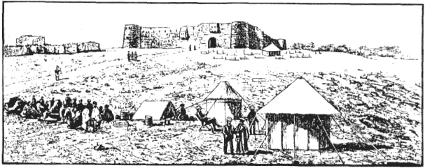
Fig.117
Which of these four possible routes—the "Ways" of the Bible—had the
Israelites taken?
In the aftermath of the Northern Crossing presentation by Brugsch,
much was made of the biblical statement regarding the,
Way of the
Land of the Philistines" which was not taken, "though it was near."
The Bible continued the statement with the following explanation:
"For the Lord said: 'Lest the people repent when they see war, and
return to Egypt.'"
It has been assumed that this "Way of the Land of
the Philistines" was the coastal route (which began at gateway "A"),
the way the Pharaohs preferred for their military and trade
expeditions, and which was strung with Egyptian forts and garrisons.
At the turn of the century, A. E. Haynes, a captain in the Royal
Engineers, studied Sinai's routes and water resources under the
auspices of the Palestine Exploration Fund. In his published report
on "The Route of the Exodus" he revealed impressive familiarity not
only with biblical scriptures, but also with the work of previous
researchers, including the Rev. F. W. Holland (who visited the Sinai
five times) and Major General Sir C. Warren (who paid particular
attention to water supplies in the "Wilderness of the Wandering" of
the Central Plain).
Captain Haynes focused on the problem of the
RouteThatWasNotTaken. Unless it was a handy and obvious way for
reaching the Israelite's goals—why was it mentioned at all as a
viable alternative? He pointed out that Kadesh-Barnea—by then
accepted as a premeditated goal of the Exodus—indeed lay within easy
reach of the coastal route. Therefore, he concluded, Mount Sinai,
situated on the way to Kadesh, also had to be located within easy
reach of the coastal route, whether or not this route was finally
taken.
Barred from the coastal Route "A," Captain Haynes concluded, it was
"the probable plan of Moses" to lead the Israelites directly to
Kadesh, with a stop at Mount Sinai, via Route "B." But the Egyptian
pursuit and the Crossing of the Red Sea may have forced a detour via
routes "C" or "D." The Central Plain was indeed the "Wilderness of
Wandering." Nakhl was an important station near Mount Sinai, before
or after reaching it.
The mount itself had to be located about 100
miles from Kadesh-Barnea, which equals (Captain Haynes estimated)
the biblical distance of "eleven days." His candidate was Mount
Yiallaq, a limestone mountain "of most impressive dimensions, lying
like a huge barnacle" on the northern rim of the Central
Plain—"exactly halfway between Ismailiyah and Kadesh." Its name,
which he spelled Yalek, "approximates closely to the ancient
Amalek,
the prefix Am meaning 'country of.'"
In the years that followed, the possibility of an Israelite journey
via the Central Plain gained supporters; some (as Raymond Weill,
Le Sijour des Israelites au desert du Sinai) accepted the Mount-near-Kadesh theory; others (as
Hugo Gressmann, Mose and seine
Zeit) believed that the Israelites turned from Nakhl not northeast
but southeast, toward Aqaba.
Others—Black, Buhl, Cheyne, Dillmann,
Gardiner, Gratz, Guthe, Meyer, Musil, Petrie, Sayce, Stade—agreed or
disagreed partly or completely. As all the scriptural and
geographical arguments were exhausted, it seemed that only an actual
field test could resolve the issue. But how does one duplicate the
Exodus?
World War I (19141918) was the answer, for the Sinai soon became
the arena of a major struggle between the British on the one hand
and the Turks and their German allies on the other hand. The prize
of these campaigns was the Suez Canal.
The Turks lost no time in crossing into the Sinai peninsula, and the
British quickly withdrew from their main administrative military
centers at ElArish and Nakhl. Unable to advance by the desirable
"Way of the Sea," for the same old reason that the Mediterranean was
controlled by the enemy's (British) navy, the Turks amassed a herd
of 20,000 camels to carry water and supplies for an advance on the
Canal via route "B" to Ismailiyah. In his memoirs, the Turkish
Commander, Djemal Pasha (Memories of a
Turkish Statesman, 1913-1919) explained that "the great problem, on
which everything hangs in these difficult military operations in the
desert of Sinai, is the question of water. In any other than the
rainy season it would be impossible to cross this waste with an
expeditionary force of approximately 25,000 men." His attack was
repulsed.
The German allies of the Turks then took matters in hand. For their
motorized equipment, they preferred the hard, flat Central Plain for
an advance on the Canal. With the aid of water engineers, they
discovered the subterranean resources and dug a network of wells all
along their lines of communication and advance. Their attack in 1916
also failed. When the British took the offensive in 1917, they
naturally advanced along the coastal route. They reached the old
demarcation line at Rafah in February 1917; within months they
captured Jerusalem.
The British memoirs on the Sinai fighting by General A. P. Wavell
(The Palestine Campaigns) has a bearing on our subject primarily by
his admission that the British High Command estimated that their
enemies could not find in the Central Plain water for more than
5,000 men and 2,500 camels. The German side of the Sinai campaigns
is told in Sinai by Theodor Wiegand and the commanding general,
F.
Kress von Kressenstein.
The military endeavor is described against
the background of terrain, climate, water sources and history,
coupled with an impressive familiarity with all previous research.
Not surprisingly, the conclusions of the German military men
parallel the conclusions of the British military men: no marching
columns, no multitudes of men and beasts could be led through the
southern granite mountains.
Devoting a special chapter to the
question of the Exodus, Wiegand and von Kressenstein asserted that
"the region of Gebel Mussa cannot come into consideration for the
biblical Mount Sinai." They were of the opinion that it was "the
monumental Gebel Yallek"— echoing the conclusions of Captain Haynes.
Or, they added, perhaps as Guthe and other German scholars have
suggested, Gebel Maghara, which rises opposite Gebel Yallek, on the
northern side of Route "B."
One of Britain's own military men, who was governor of the Sinai
after World War I, became acquainted with the peninsula during his
long tenure there as perhaps no single person in modern times until
then. Writing in Yesterday and Today in Sinai, C. S. Jarvis too
asserted that there was no way the Israelite multitudes (even if
their numbers were smaller than 600,000, as W.M.F. Petrie had
suggested) and their livestock could have traveled through—much less
sustained themselves for more than a year—in the "tumbled mass of
pure granite" of the southern Sinai.
To the known arguments, he added new ones. It had already been
suggested that the manna which served in lieu of bread was the
edible, white, berrylike resinous deposit left by small insects
that feed on the tamarisk bushes. There are few tamarisks in
southern Sinai; they are plentiful in northern Sinai.
Next fact
concerned the quails, which provided the meat to eat. These birds
migrate from their native southern Russia,
Rumania and Hungary to winter in the Sudan (south of Egypt); they
return northward in the spring. To this day, the Bedouins easily
catch the tired birds as they alight on the Mediterranean coast
after long flights. The quails do not come to the southern Sinai;
and if they did, they could not possibly fly over the high peaks of
that area.
The whole drama of the Exodus, Jarvis insisted, was played out in
the northern Sinai. The "Sea of Reeds" was the Serbonic Sealet
(Sebkhet el Bardawil in Arabic) from which the Israelites marched
southsoutheast.
Mount Sinai was Gebel Hallal—
"a most imposing
limestone massif over 2,000 feet high and standing in the midst of a
vast alluvial plain all by itself."
The mountain's Arabic name, he
explained, meant "The Lawful"—as befits the Mount of the Lawgiving.
In the years that followed, the most pertinent research on the
subject was conducted by scholars of the Hebrew University of
Jerusalem and other Hebrew institutions of higher learning in what
was then Palestine. Combining their intimate knowledge of the Hebrew
Bible and other scriptures with thorough onsite investigations in
the peninsula, few found support for the southern location
tradition.
Haim BarDeroma (Hanagev and Vze Gvul Ha'aretz) accepted a Northern
Passage but believed that the Route then took the Israelites south,
through the Central Plain, to a volcanic Mount Sinai in Transjordan.
Three noted scholars—F. A. Theilhaber, J. Szapiro and
Benjamin Maisler (The Graphic Historical Atlas of Palestine: Israel in
Biblical Times)—accepted the Northern Passage via the shoal of the Serbonic Sea.
ElArish, they said, was the verdant oasis of Elim;
Mount Hallal was Mount Sinai. Benjamin Mazar, in various writings
and in Atlas Litkufat Hatanach, adopted the same position. Zev
Vilnay, a biblical scholar who hiked in Palestine and Sinai
literally from end to end (Ha'aretz Bamikra), opted for the same
route and mount.
Yohanan Aharoni (The Land of Israel in Biblical
Times), accepting the possibility of a Northern Passage, believed
that the Israelites journeyed toward Nakhl in the Central Plain; but
then proceeded to a Mount Sinai in the south.
As the debate continued to engross the scholarly and biblical world,
it became apparent that the basic unresolved issue was this: Insofar
as the Crossing was concerned, the weight of the evidence negated a
northern body of water; but insofar as Mount Sinai was concerned,
the weight of the evidence negated a southern location. The impasse
focused the attention of scholars and explorers on the only
remaining compromise: the Central Plain of the Sinai peninsula.
In
the 1940s, M. D. Cassuto (Commentary on the Book of Exodus and other
writings) facilitated acceptance of the central route idea by
showing that the RouteNotTaken ("The Way of the Land of the
Philistines") was not the longheld sea route, but the more inland
route "B." Therefore, a Crossing via Gateway "C" leading southeast
to the Central Plain was in full accord with the biblical
narrative—without requiring a continued journey to the south of the
peninsula.
The long occupation of the Sinai by Israel, in the aftermath of the
1967 war with Egypt, opened up the peninsula to study and research
on an unprecedented scale. Archaeologists, historians, geographers,
topographers, geologists, engineers examined the peninsula from tip
to toe. Of particular interest have been the explorations by the
teams of Beno Rothenberg (Sinai Explorations 1967-1972 and other
reports), mostly under the auspices of TelAviv University. In the
northern coastal strip, many ancient sites reflected the
"bridgelike nature of this area."
In the Central Plain of north Sinai, no
ancient sites of permanent abode were found, but only evidence of
camping sites, attesting that this was only a transit area. When the
camping sites were plotted on the map, they formed "a clear line
from the Negev toward Egypt, and this should be considered as the
direction of prehistoric movements across the 'Desert of the
Wanderings' (the elTih)."
It was against this newly understood background of the ancient Sinai
that a Hebrew University biblical geographer, Menashe HarEl,
offered a new theory (Massa'ei Sinai). Reviewing all the arguments,
he pointed out the submerged ridge (see Fig. 116) which rises
between the Great and the Little Bitter Lakes. It is shallow enough
to be crossed if a wind blows away the waters; it was there that the
Crossing had taken place. Then the Israelites followed the
traditional route south; passing Marrah (Bir Murrah) and Elim (Ayun
Mussa), they reached the shores of the Red Sea and encamped there.
Here HarEl offered his major innovation: having journeyed along the
Gulf of Suez, the Israelites did not go all the way south. They
proceeded only some twenty miles to the mouth of Wadi Sudr—and
followed the wadi's valley into the Central Plain, proceeding via
Nakhl to KadeshBarnea.
HarEl identified Mount Sinai with
Mount SinnBishr which rises some 1,900 feet at the entrance to the wadi,
and suggested that the battle with the Amalekites had actually taken
place on the coast of the Gulf of Suez. This suggestion has been
rejected by Israeli military experts familiar with the terrain and
history of warfare in the Sinai.
Where, then, was Mount Sinai? We must look again at the ancient
evidence.
The Pharaoh, in his Journey to the Afterlife, went eastward.
Crossing the watery barrier, he set his course to a pass in the
mountains. He then reached the Duat, which was an ovalshaped valley
surrounded by mountains. The "Mountain of Light" was situated where
the Stream of Osiris divided into tributaries.
The pictorial depictions (Fig. 16) showed the
Stream of Osiris
meandering its way through an agricultural area, distinguished by
its ploughmen.
We have found similar pictorial evidence from Assyria. The Assyrian
kings, it should be remembered, arrived at the Sinai from the
opposite direction to that of the Egyptian kings: from the
northeast, via Canaan. One of them, Esarhaddon, engraved on a stela
what amounts to a route map of
his own quest for "Life" (Fig. 118).
It shows the date palm—the code
emblem for the Sinai; a farming area symbolized by the plough; and a
"Sacred Mount." In the upper register we see Esarhaddon at the
shrine of the Supreme Deity, near the Tree of Life. It is flanked by
the sign of the bull—the very same image (the "golden calf") that
the Israelites had fashioned at the foot of Mount Sinai.
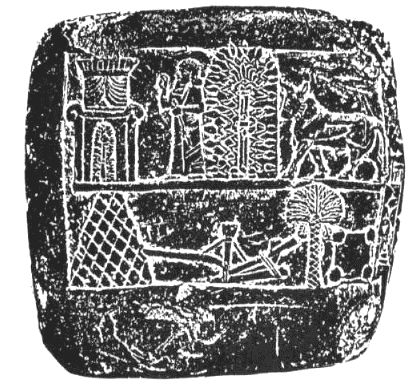
Fig. 118
All this does not bespeak the harsh, barren granite peaks of
southern Sinai. Rather, it suggests northern Sinai and its dominant
Wadi ElArish, whose very name means Stream of the Husbandman. It is
among its tributaries, in a valley surrounded by mountains, that the
Mount was located.
There is only one such place in the whole of the Sinai peninsula.
Geography, topography, historical texts, pictorial depictions—all
point at the Central Plain in Sinai's northern half.
Even E. H. Palmer, who went so far as to invent the RasSufsafeh
twist in order to uphold the southern identification, knew in his
heart that a desert that stretches as far as the eye can see, and
not a peak in a sea of granite mountains, was the location of the
Theophany and the wanderings of the Israelites.
"The popular conception of Sinai," he wrote in The Desert of the
Exodus, "even in the present day, seems to be that a single isolated
mountain which may be approached from any direction rises
conspicuously above a boundless plain of sand. The Bible itself, if
we read it without the light of modern discovery, certainly favors
this idea... . Mount Sinai is always alluded to in the Bible as though it stood alone and
unmistakable in the midst of a level desert plain."
There indeed exists such a "level desert plain" in the Sinai
peninsula, he admitted; but it is not covered with sand:
"Even in
those parts [of the peninsula] which approach most nearly to our
conception of what a desert ought to be—a solid ocean bounded only
by the horizon or by a barrier of distant hills—sand is the
exception, and the soil resembles rather a hard gravel path than a
soft and yielding beach."
He was describing the Central Plain. To him, the absence of sand
marred the "desert" image; to us, its hard gravel top meant that it
was admirably suited for the Spaceport of the Nefilim. And if
Mount Mashu marked the gateway to the Spaceport, it had to be located on
the outskirts of this facility.
Have then generations of pilgrims gone south in vain? Did the
veneration of the southern peaks begin only with Christianity? The
discovery by archaeologists atop these mounts of shrines, altars,
and other evidence of worship from olden days attests differently;
and the many inscriptions and rock carvings (including the Jewish
Candelabra emblem) by pilgrims from many faiths and over many
millennia bespeak a veneration going back to Man's earliest
acquaintance with the area.
As one almost wishes there were two "Mounts Sinai" to satisfy both
tradition and facts, it turns out that such notions too are not new.
Even before the last two centuries of concerted effort to identify
the Mount, biblical and theological scholars had wondered whether
the various biblical names for the Sacred Mount did not indicate
that there originally were two sacred mountains, not one.
These
names included
-
"Mount Sinai" (the Mountain of/in Sinai), which was
the Mount of the Lawgiving
-
"Mount Horeb" (the Mountain of/in the
Dryness)
-
"Mount Paran," which was listed in Deuteronomy as the
mount in Sinai from which Yahweh had appeared unto the Israelites
-
"the Mountain of the Gods," where the Lord first revealed
himself unto Moses
The geographic location associated with two of the names is
decipherable. Paran was the wilderness adjoining KadeshBarnea,
possibly the biblical name for the Central Plain; so that "Mount
Paran" had to be located there. It was to that Mount that the
Israelites had gone. But the Mount where Moses had his first
encounter with the Lord, "the Mountain of the Gods," could not have
been too far from the Land of Midian; for
"Moses was shepherding the
flock of Jetro, his fatherinlaw, the priest of Midian; and he led
the flock unto the wilderness, and came unto the Mountain of the
Gods, unto Horeb."
The abode of the Midianites was in southern
Sinai, along the Gulf of Aqaba and astride the copperworking areas.
"The Mountain of the Gods" must have been located somewhere in an
adjoining wilderness—in southern Sinai.
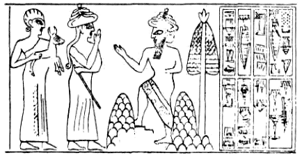
Fig.119
There have been found Sumerian cylinder seals depicting the
appearance of a deity unto a shepherd. They show the God appearing
from between two mountains (Fig. 119), with a rocketlike tree
behind him—perhaps the Sneh ("Burning Bush") of the biblical tale.
The introduction of two peaks in the shepherd scene fits the
frequent biblical reference to the Lord as El Shaddai—God of the Two
Peaks. It thus raises yet another distinction between the Mount of
the Lawgiving and the Mountain of the Gods: the one was a solitary
mount in a desert plain; the other seems to have been a combination
of two sacred peaks.
The Ugaritic texts too recognize a "Mountain of the young Gods" in
the environs of Kadesh, and two peaks of El and Asherah—Shad Elim,
Shad Asherath u Rahim—in the south of the peninsula. It was to that
area at mebokh naharam ("Where the two bodies of water begin"),
kerev apheq tehomtam ("Near the cleft of the two seas") that
El had
retired in his old age. The texts, we believe, describe the southern
tip of the Sinai peninsula.
There was, we conclude, a Gateway Mount on the perimeter of the
Spaceport in the Central Plain. And there were two peaks in the
peninsula's southern tip that also played a role in the comings and
goings of the Nefilim. They were the two peaks that measured up.
Back to Contents
|