|


by
Joseph P. Skipper
March 6, 2005
from
MarsAnomalyResearch Website

click image to
enlarge
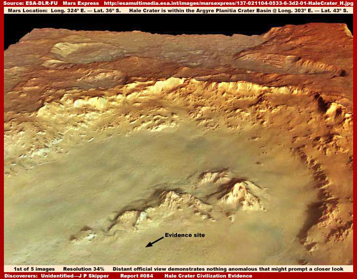
The above first image is of
Hale Crater located within the much greater Argyre Planitia
Crater Basin. This image of it is beautiful isn't it. This
appearance is a signature characteristic of the often visually
stunning ESA Mars Express HRSC (High Resolution Stereo
Camera) imaging as it is presented to the public and media. However,
what we all need to be aware of is that this pretty picture for the
public and media is partially art work and not be confused with the
raw visual science data as seen by the Mars Express camera
systems that would not have this information overlaid on it.
This pretty look is accomplished right here on Earth by some heavy
artificial processing and manipulation of the image to this effect.
That fact wouldn't be so bad if the image manipulation was just
limit to color but the truth, in my opinion, is that the ESA
imaging is so heavy with map type carpeting image tampering
obfuscation that quality anomalous discovery information can
very rarely be found in it. In fact, this beautiful color rides on
the back of this type of software mapping into the terrain. This
problem is so prevalent in the ESA imaging as released to the
public that I long ago came to the personal conclusion that it
generally just isn't practically worth me devoting much of my very
limited time to trying very hard to find something in it. Yet, no
matter how diligent the tampering, mistakes are still made in its
application and such mistakes can produce discoveries providing some
real information. That is the situation we have here in this report
with this image.
In the above first image, which is only 34% of the original full
resolution size and similar to the even smaller type of imaging you
will often see presented in the media, note the black arrow and
label pointing out the evidence site location that the strong
anomalous content of this report is based on. Don't see anything
suggestive or anomalous there? Well you are seeing correctly because
you are seeing only what the secrecy agenda wants you to
see and that is essentially nothing but a little, and I do mean
a little, geology in the form of just the tops of some rough
mountainous terrain. This limited view coincides nicely with the
fact that the main past and current scientific debate associated
with the Hale Crater environs centers primarily around the
question of possible past ancient water erosion on its worn
slopes.
In other words, the focus is all about geological evidence and
little else and this kind of beautiful designer imaging is designed
to get in behind and reinforce that perception and psychology. Yet,
all of the more smooth areas you see in the above first image,
regardless of color or size, is map type smudge image tampering
application and you'll note that this accumulatively constitutes
the great bulk of the image area and only a little of any natural
geological forms stick up through this covering.
In fact, it is the universal smoother texture image tampering that
gives this general scene is worn look illusion that current
scientific debate is so focused on. This kind of thing not only
serves to cover up any anomalous evidence that may be present
in a particular image like this one, it also from official image to
image accumulatively in the many hundreds and thousands creates the
universal perception illusion that what one is looking at in these
images is all real terrain when the truth is that only the tops of
some of the rougher geology is real in a scene like this. This is
how misdirection and manipulation of perception is done in the world
of planetary satellite imaging.

For those of you who may be hesitant to
accept this, resolution is only a matter of common sense. I invite
you to take a look at the fifth and last image
(above) in my previous Report #055 titled Towers In
The Sun (click above image). This
standard commercial quality technology image demonstrates satellite
older than ESA's current science imaging technology of an Earth city
from the satellite over 400+ miles out as compared to the
230 mile average for satellites circling Mars and through
Earth's heavy atmospheric envelope and cloud cover as compared to
Mars thin much clearer atmospheric cover.
Earth satellite images like this should provide very clear insight
as to what kind of minimum quality that we have a right to
expect from this planetary science imaging that uses the best
cutting edge equipment of the time and not available commercially.
Yet, this is clearly not what we are getting. Oh the real and much
clearer science imaging data is out there somewhere within secrecy
control but only the poorest quality heavily manipulated and
obscured imaging full of misdirection and illusion is made available
to the public and researchers as evidenced by the first and second
images you see here in this report.

click image to
enlarge
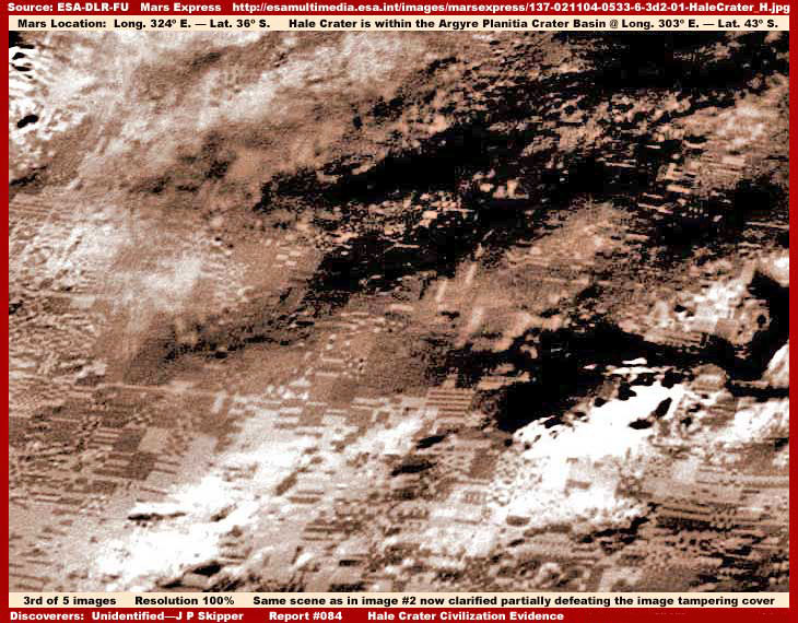
Now the above second image is
again the official ESA image (without any work in it by me)
but specifically of part of the anomalous evidence site and this
time shown at the full official 100% resolution size. The anomalous
evidence site is below, to the left of off screen, and to our right
of the three arrows. The mountains you see that I have included in
this view above within the Hale Crater basin and their
orientation provide the needed ease of location factor. As you can
see, any evidence there is very faint in the official imaging and
therefore so very easy to miss.
The only thing that can be seen here in this official view is some
faint organized patterns uncharacteristic of natural geology under
and through the partially transparent smudge image tampering cover.
The above marginal view of the faint evidence is a bit better seen
in the original official
image found below than in my above necessarily lesser
quality compressed image sized for this Web presentation.
For a researcher worth his or her salt, this faintly seen but
definite organized pattern evidence is the clue that indicates the
need for closer examination and then the attempts at defeating the
obscuring image tampering treatment. I have been aware of this
anomalous evidence at this site all the way back into the MGS
MOC data but it has always been too obscured not allowing adequate
defeat of the image tampering. When I have promising but only
suggestive evidence like this, I often hold off reporting on it
hoping with the passage of time to find a better image of the
anomaly site that will allow more detail to be brought out.
That was my situation with this evidence. I had looked at various
MOC, THEMIS and ESA imaging of this site but could
never visually get the evidence via graphics work beyond being
merely suggestive and not having much respect for the ESA imaging,
my research into it wasn't as detailed as it should have been.
However, thankfully along comes a viewer (who wishes her identity
withheld) finding this particular ESA image that I missed
completely on her own that is the basis of this report. When she
brought it to my attention, her imaging was too close to the
evidence obscuring it too much so that it to was still only
suggestive. But, it was plenty good enough for me to see by her
graphics work that defeating the Hale Crater image tampering
covering was possible in the image she had found, at least to a
greater extent than heretofore in my experience. The result is as
you see in the following three images.
click image to
enlarge

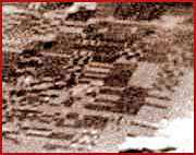 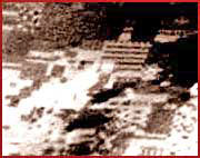 
Now remember that the above third
larger image with its accompanying three smaller thumbnail size
ever so slightly clearer images of the Hale Crater civilization
evidence is a distant wide view and the result of only a partial
defeat of only the overall covering slightly transparent smudge
image tampering obfuscation you see in the first two official
images. So only various areas of the evidence can be seen adequately
while other areas in the scene are still seriously impacted by image
tampering more resistant to defeat. Note that I got rid of the nice
beautiful but fuzzy, highly reflective, and obscuring ESA processing
and color and introduced this alternative color to give the evidence
a little better definition.
I've waited patiently a long time to present this evidence site and
we all owe this lady viewer a lot for bringing this image to my
attention as well as to the secrecy types for choosing poorly and
making the mistake of using smudge tampering with just a little too
much transparency to it in this particular image. As I have stated
over and over again, it is only via full awareness of the
presence of the image tampering and capitalizing on the mistakes
made in its application that a little true hard evidence like this
filters through to us rather than just the designer pabulum and
illusion that the secrecy agenda would prefer that we be limited to.
As you can see in the above image, I don't think even the most in
denial loyal to the official view person can see this as anything
other than the civilization evidence that it clearly is and on
another world. There can be no confusing this distantly seen wide
area highly organized geometric patterns so typical of
intelligent life civilization evidence sites with natural
geology or misleading imaging artifacts, etc. Now the next two
images below will show a closer view to the left and right of the
above third image scene.

click image to
enlarge
The above fourth image is a 180%
zoom (as far as I could go before getting just too blurry) closer
view of the general wide field scene to the left in the third image
in this report. This is still a distant blurry view but still
informative none the less. The civilization evidence is so
thick here and in such variety that I have elected not to obscure
anything with arrows and labels under the assumption that most of
you can recognize much of this evidence for what it is. Just keep in
mind that this is a distant satellite view, not a closer
aerial view, and the general image quality has been degraded at
official level resulting in the blurry look that I cannot help.
Except for some of the evidence in Report #010 titled "Domes
& Plant Puffing Vapor" and possibly Report #006 titled "Water
Industrial Site, et al," due to the large variety of
shapes and structures, this site is unique among the evidence I've
presented. Why? Because the civilization evidence here
appears to be spread out in the terrain as a great variety of
different probably industrial and/or possibly military uses with
many lower profile structures as compared to the usual concentrated
living and/or general business sites I've so far mostly reported on
with crowded densely packed tall high density towering structures.
Further, the patterns and structure evidence that we can see
reasonably well here (for planetary satellite imaging as released)
are relatively small and/or lower profile. That's because the
tampering depended on the overall general upper layer
semitransparent smudge treatments to hide this smaller size evidence
to continue to provide some misleading visual surface texture
patterns. That type of general tampering cover is what my
clarification work did a fairly good job of defeating.
However, the darker areas and the over saturated light color
areas are I suspect larger more readily recognizable geometric
structures that have higher priority object specific tampering
applied on them at higher resolution levels in deeper flattened
layers that my relatively simple clarification work couldn't deal
with. So this evidence remains hidden under the more individual
tampering treatments. I suppose you can't hope to have your cake and
eat it to as the old saying goes.

The above fifth image is also a
180% zoom closer view of the general wide field scene but to the
right in the third image in this report. Again I've elected not to
obscure anything with arrows and labels pointing out features. Many
will see and describe more detail of some of the objects seen in the
last three images in this report. Some such perceptions may be
correct but most will no doubt be wide of the mark and seeing things
just not able to be seen adequately in this limited quality publicly
released satellite imaging.
However, that kind of more risky extrapolation of the evidence is
not the primary purpose of my reporting here. I see that as much
less important at this point than simply reporting the straight
forward but extraordinary message and realization that we are
looking at intelligent life advanced civilization evidence on
another world and that this is a reality and that we are going to
have to wake up to and deal with this fact.
Just look at evidence like this, there can simply be no confusing
this type of evidence with natural geology or imaging artifacts. We
as a people following the official lead are just beginning to start
to consider that surface water may have once existed on Mars but
only in the ancient past. That is the secrecy agenda muddy water
pabulum preferred and promoted for us all. But, we are not stepping
up to the reality plate in accepting just this little ultra
conservative information tidbit. Likewise, reluctantly just
beginning to start to consider that organic life of some kind and
perhaps even intelligent life may have once existed in the ancient
past possibly leaving some old dead ruins behind we can eventually
explore is again us just not stepping up to the reality plate.
In scenes like this, think what the real untampered with
unobscured much higher resolution satellite imaging science data
never released to us would have to reveal about sites like this
offering tremendous insight so very far beyond the sparse and weak
but still extraordinary information we see here in this badly
crippled imaging. Think about what some in the secrecy agenda would
have to know about sites like this but never share with those that
support and pay for this information's acquisition. That so many of
us are hiding from and preferring our denial pabulum on information
like this is what the secrecy agenda prefers to believe about you
and I. This perception dovetails in nicely with their secrecy agenda
addiction with its resulting elitism and alienation from the public
interest they are suppose to serve.
But, are they right? Is it what you really want? If not, then it's
time to loudly and forcefully communicate your willingness to face
up to information like this and demand of your media and political
leadership to start looking into this in depth and providing this
type of information the full investigative exposure that it requires
and then let the people judge any merit it may have for themselves.
The science and academic communities have evidently abdicated their
responsibility in this regard to the secrecy agenda by swallowing
the official science data misdirection and illusion pabulum hook
line and sinker, so it is up to us to start this incredible
information moving toward greater awareness, responsibility and
debate.
We are all of us headed relentlessly toward dramatic changes in
our lives arising from our true greater environment. It is a
natural outgrowth of this speeded up high tech information age we
now live in where a massive secret and ignorance like this cannot
ultimately stand. The change cannot be avoided and especially not by
pretense, official or otherwise. The question is will we as a people
be caught by surprise and be swept along out of control by
inevitable events or will we start anticipating and preparing now by
allowing this kind of preparatory information onto our mental radar?
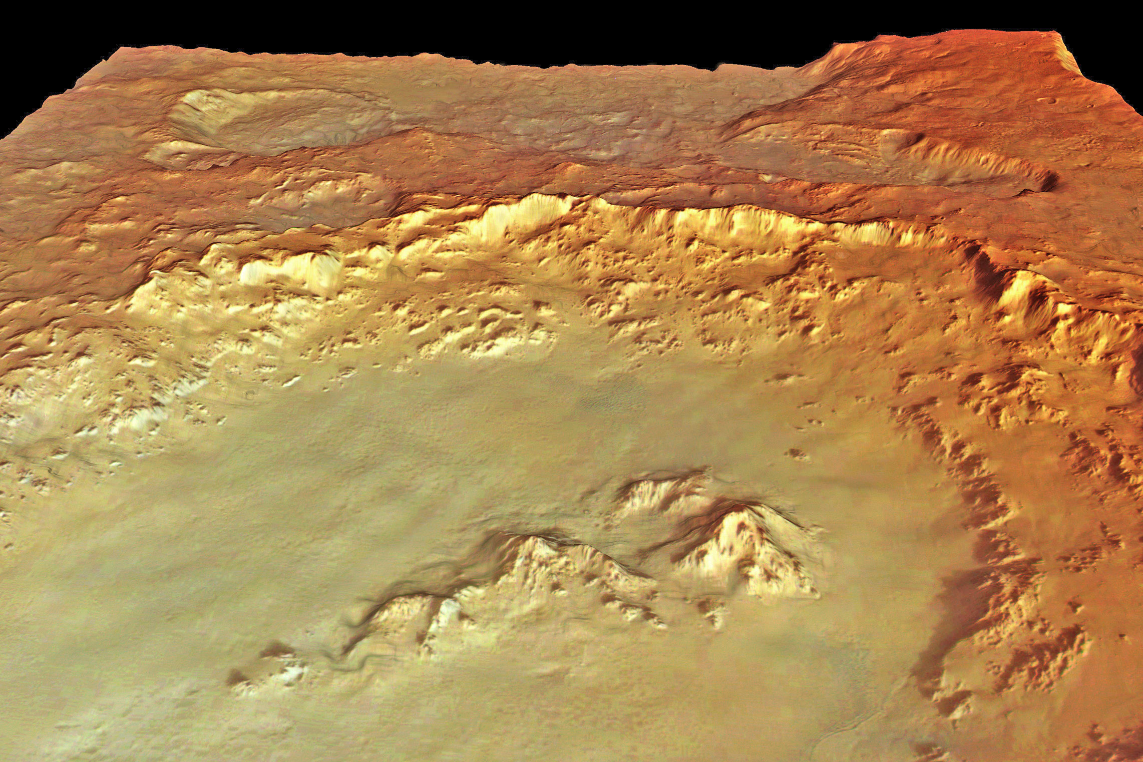
DOCUMENTATION

The above
official ESA image is the source
for this report that came to us via the excellent work of a female
viewer who prefers to keep her identity private. In the official
image, be prepared to see the anomalous civilization evidence
patterns very faintly through and below the slightly transparent
smudge image tampering covering using the second image in this
report and its mountains for location of the evidence site.
However, remember that you will not be seeing any civilization
evidence detail beyond the faint organized patterns in this
official image unless you are prepared to do graphics clarification
work with it. If you choose that path, first loose the pretty,
highly reflective but obscuring ESA colors to standard black
and white and then proceed with darkening and contrast work and
adding another color if you wish. The evidence detail seen in the
last three images in this report will begin to reveal itself.
|