
from
LunarRepublic Website
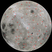
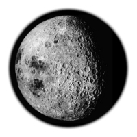
Often referred to incorrectly as the "dark
side" of the Moon - actually, at least half of the Moon is
receiving sunlight at all times - humans did not get their first
look at the Lunar far side until the Soviet Union's Luna 3
sent back a crude photograph in October 1959.
Devoid of the vast,
smooth mare (sea) regions found on the visible near side,
the far side is essentially an immense crater field punctuated by
only a few minor maria, including,
-
Mare Moscoviense (upper left in the
photograph)
-
Mare Ingenii (lower center)
-
Mare
Orientale (lower right edge)
-
Mare Australe (lower left edge)
spans the region between the near and far sides on the visible
southeastern limb
Please note that the geographic directions east
and west are reversed on the far side.
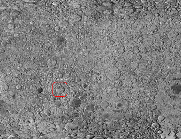
ABOUT THIS PHOTOMAP:
Due to the lack of quality, full-disc photographs of the Lunar far
side, we have chosen to include this flat projection because of
the amount of detail it offers. While this projection may be
slightly confusing at first, please note that objects appear
closer to their actual shape, i.e., craters appear circular,
rather than compressed, as you approach the edges of the photomap.
This general map closely approximates Rükl's Atlas Of The Moon,
p. 191.
NAVIGATION NOTES:
·
Moving your cursor over major
geographical features in the photograph below will trigger
identifying flags.
· When displayed, approximate crater
diameters (in kilometers) are shown within parenthesis.
· To move to an adjoining sector (when available),
click on the direction indicator. For example, clicking on the
"North" indicator moves you to the sector above the
current one displayed.
|