|
July 2010 from KineticTruthFiles Website
BP Oil Spill may cause an irreparable damage to the Gulf Stream global climate thermoregulation activity
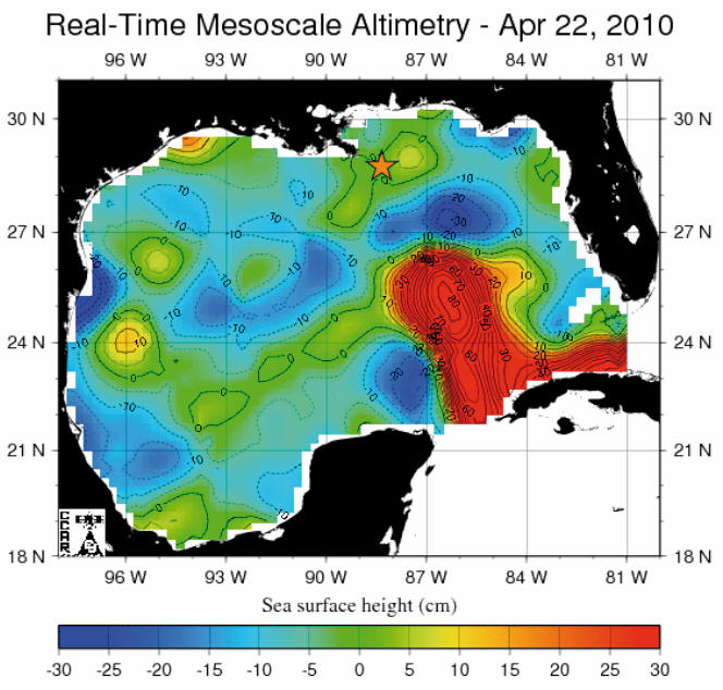
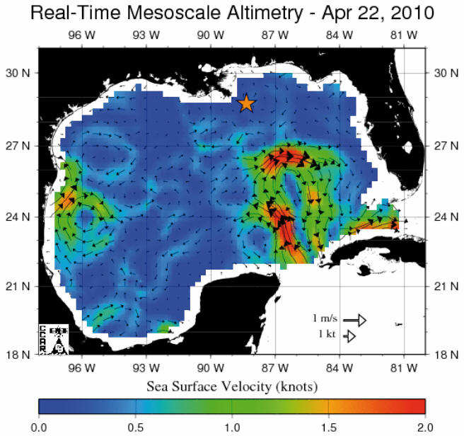
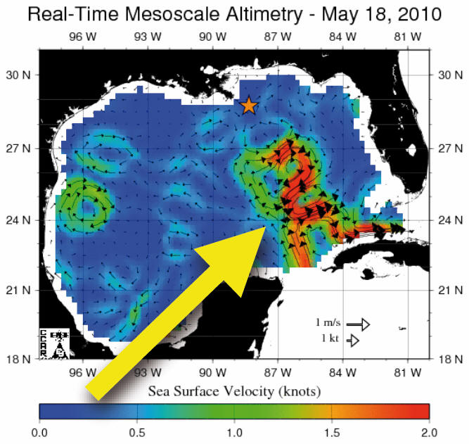
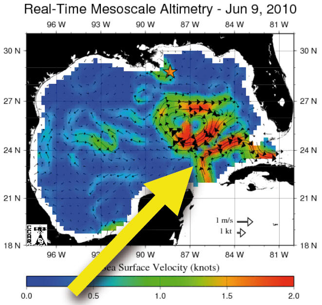
The latest real time satellite (Jason, Topex/Poseidon, Geosat Follow-On, ERS-2, Envisat) data maps of May-June 2010 processed by CCAR1,2 (Colorado Center for Astrodynamics Research), checked at Frascati Laboratories by the means of the SHT congruent calculus3 and compared with past years data, show for the first time a direct evidence of the rapid breaking of the Loop Current, a warm ocean current, crucial part of the Gulf Stream.
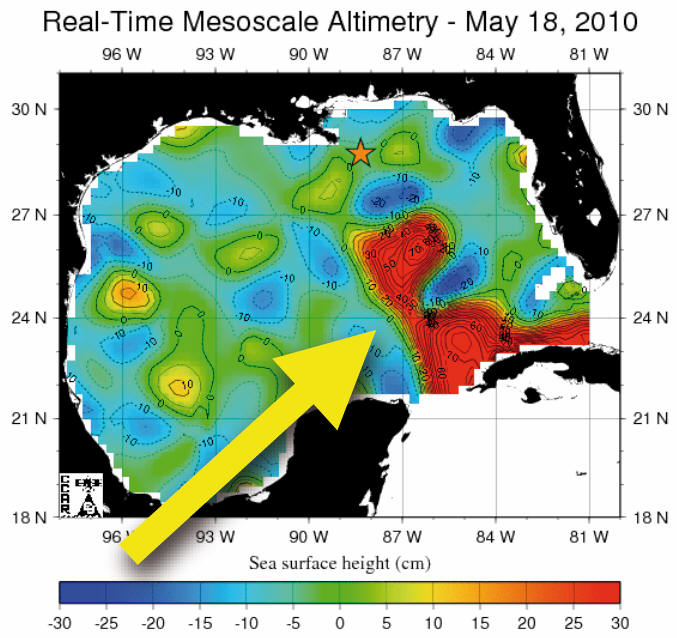
As displayed both by the sea surface velocity maps and the sea surface height maps, the Loop Current broke down for the first time around May 18th and generated a clock wise eddy, which is still active (see Fig. 1 below).
Figure 1 - Real time
satellites data maps. Real time sea surface height maps (above) and
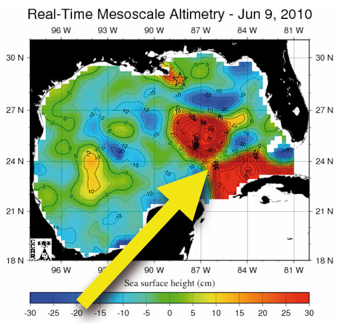
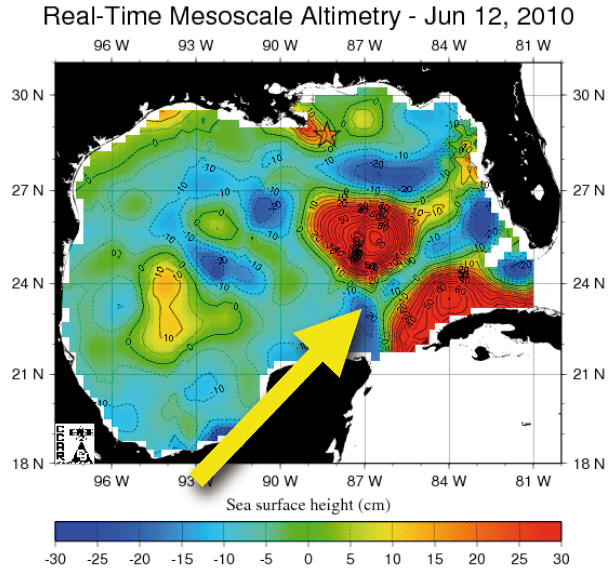
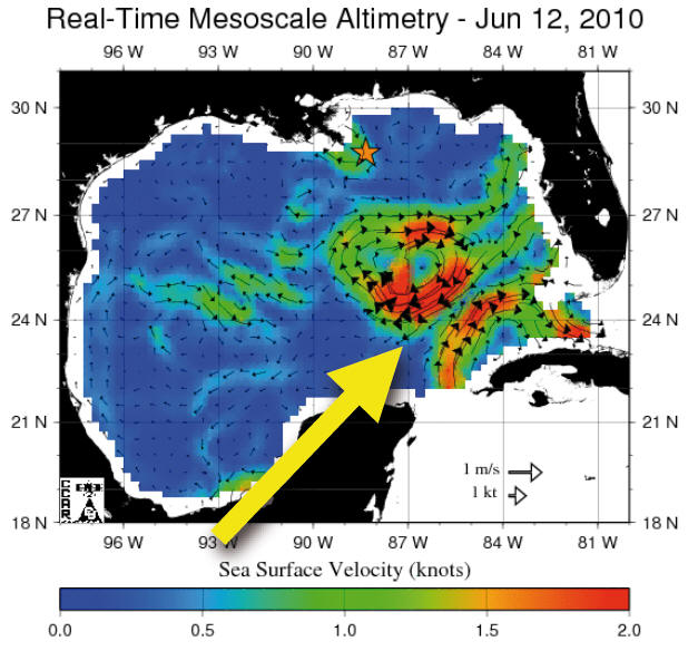
As of today the situation has deteriorated up to the point in which the eddy has detached itself completely from the main stream therefore destroying completely the Loop Current, as in figure 2 below, dated June 12, 2010.
Figure 2 above - Real time satellites data maps updated. Real time sea surface height map (left) and sea surface velocity maps (right) updated on June 12th processed by CCAR1,2 and checked at LNF (Frascati) by SHT calculus.3 The star indicates the site of BP platform "Deepwater Horizon".
The yellow arrow
indicates the breaking of the Loop Stream. Since comparative analysis with past satellite data until may 2010 didn't show relevant anomalies, it might be therefore plausible to correlate the breaking of the Loop Current with the biochemical and physical action of the BP Oil Spill on the Gulf Stream.
Acknowledgements
We acknowledge,
We also acknowledge the University of Colorado, Boulder, USA:
|