|
by Neida Rios from InstinctiveWisdom Website
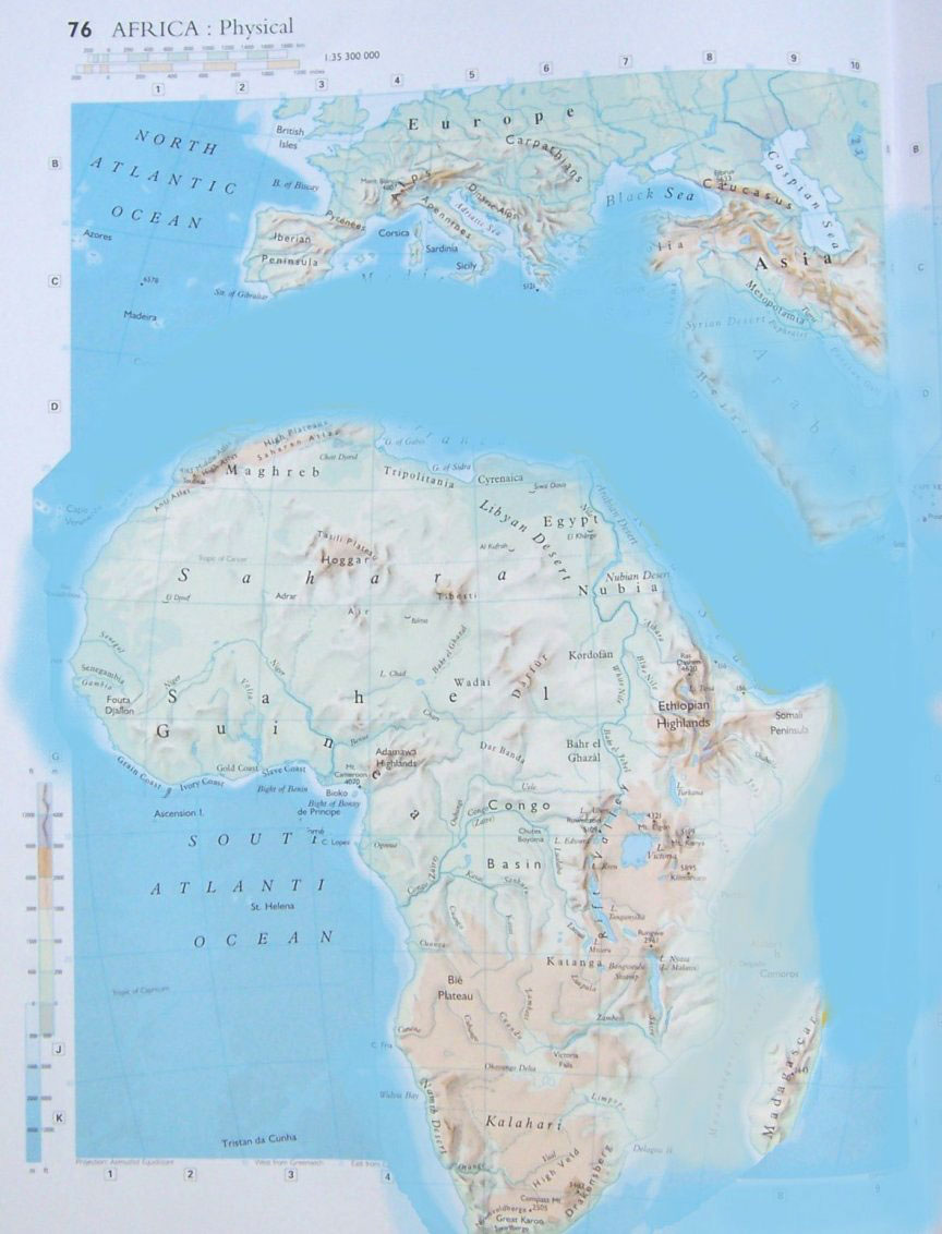
You will notice that Africa is nearly unaffected as far as losing land goes.
The two biggest things that occur here are that the whole continent shifts down from where it was by hundreds of miles and the raising of the land between Madagascar and Africa.
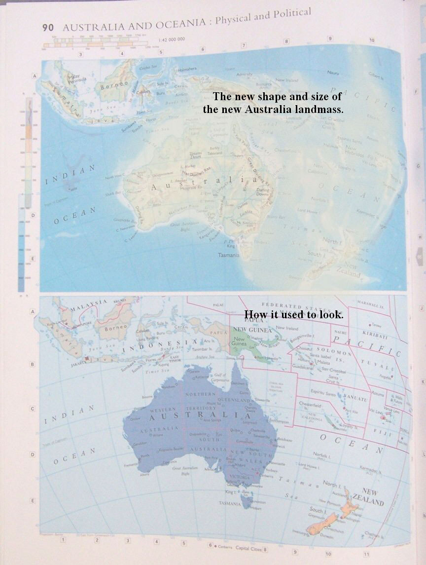
The new shape and size of the new
Australia landmass. How it used to look.
A new corral reef will develop on the North East region of this new landmass. It will be close to what is the location of the Solomon Islands, Malatia and San Cristobal Islands.
Where once was ocean now is land. New
Zealand and Australia are again 'one'. The color of the
new land is representative of its height above sea level, thus this
will not be arid and dry but luxuriant in after it has had some time
for vegetation and other life to grab hold.
Indonesia and most everything around it is going to sink.
Java, Madura, and Bali as the insets of the above picture show will sink and go under as will most of Malaysia.
There is a very tall and famous building in Kuala Lumpur which because of its quality of engineering may survive earthquakes and the sinking into the ocean for awhile, that is to say you may still see it peaking over the surface of the ocean.
You can see that Most of the Philippines are gone.
Very little lies above water level now.
Not much left of Japan, just the tallest areas.
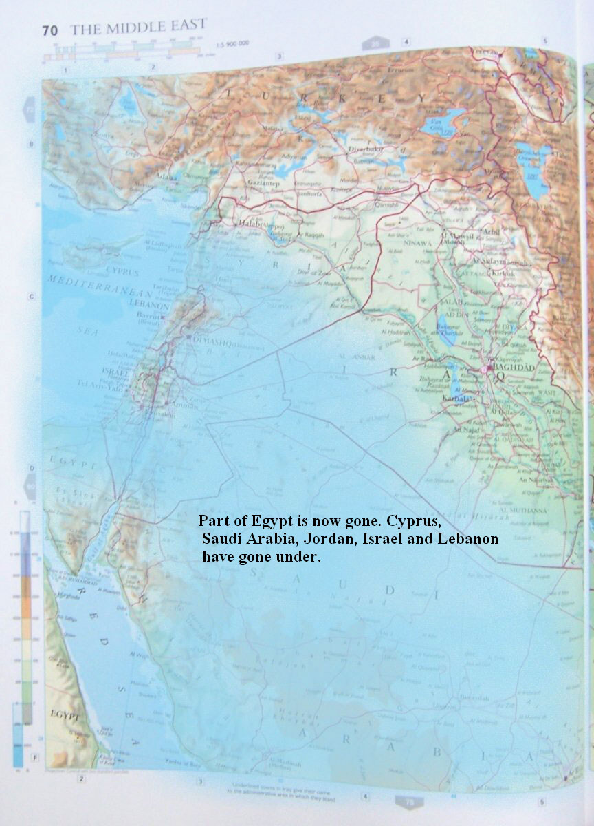
The so-called 'Holy Land' is now underwater with most of Israel, Lebanon, Jordan and Syria
Part of Egypt is now gone.
Cyprus, Saudi Arabia, Jordan, Israel and
Lebanon have gone under.
You will notice that some higher areas close to Egypt here stay atop the new water level.
Kuwait, Bahrain, Qatar, United Arab Emirates, Dubai, Oman and Saudi Arabia's eastern shore all go under water. Iran suffers major earthquakes (no surprise there) but otherwise keeps most of its present shape.
You will notice that the ocean has more than crept inland all around the Adriatic Sea area.
Most of Venice is under water now as is Rome and three quarters of Italy.
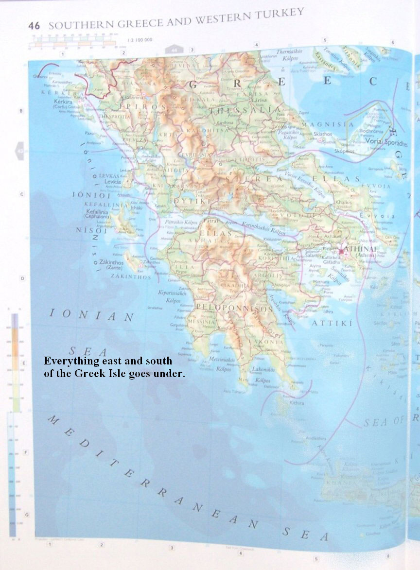
Everything east and south of the Greek Isles goes under.
Most of South Western Turkey is under water now with just some of the higher mountain ranges and mountains remaining.
Nearly all the islands that used to be off the west coast will also go under.
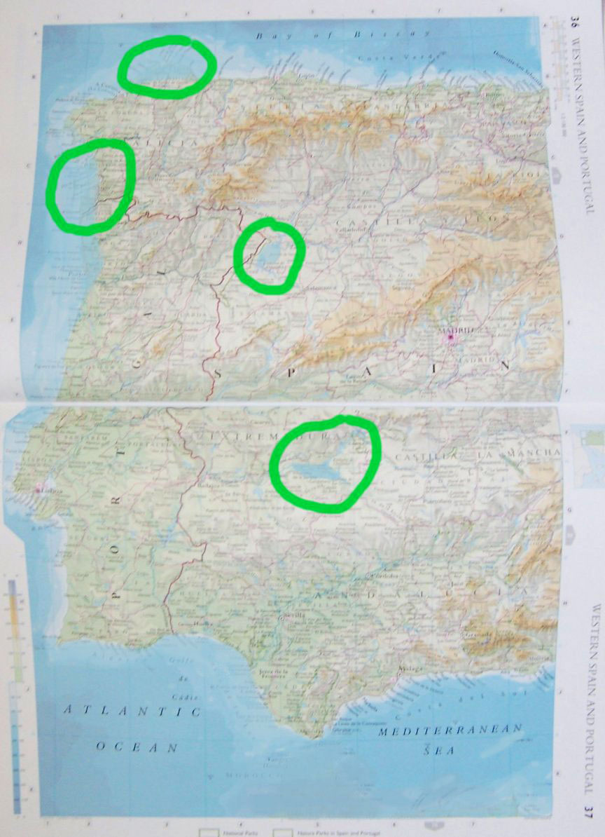
On Western Spain the Straits of Gibraltar will go under.
There will be a new lake around Orellana and La Serena. The town of Alcocer will be under water there. There is going to be a lake between the Duero and Almendra Rivers.
The areas of change I saw I have outlined.
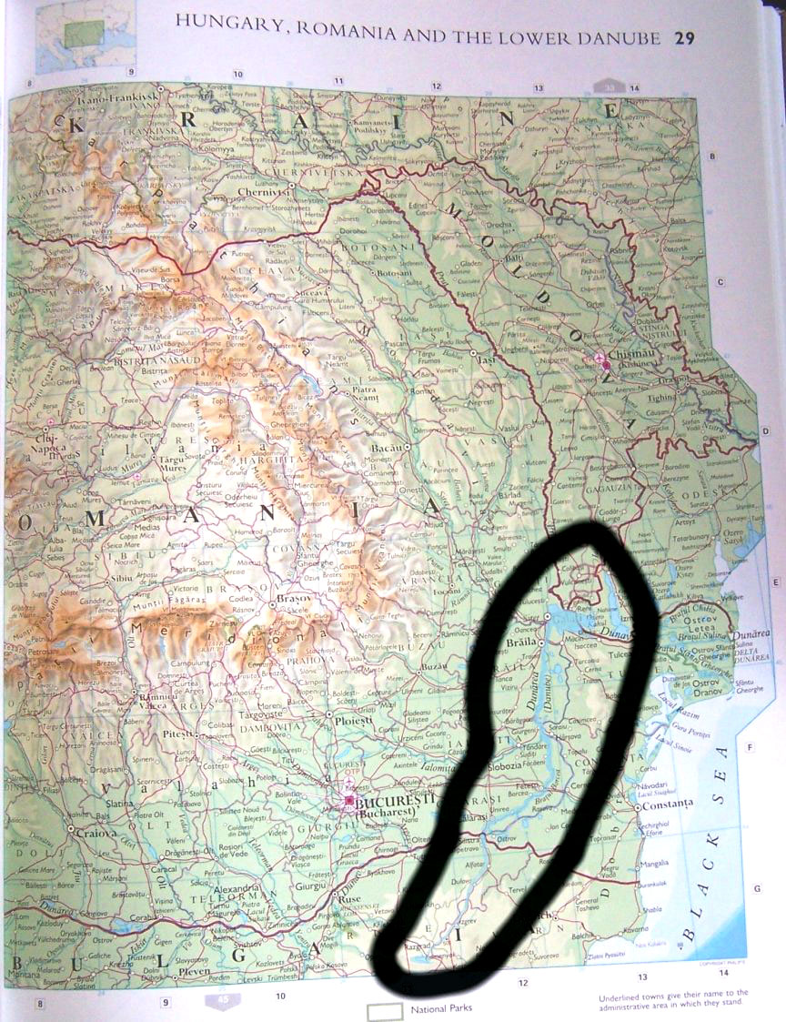
In Romania the Danube will double in size and take a new course moving past Silistra to Lake Kamenyak (at the bottom of the map) which will grow a fair degree.
Here is the new look to our Country's west coast.
While California itself did not break off and slip into the sea, a very large portion of it has sunken and gone under water none-the-less, and this thanks to shifting tectonic plates and the earthquakes that accompany them. San Francisco and most of the bay area is under water.
Now we have an inland sea with only the mountain peaks (now islands) from what was the Big Sur area (below where Monterey was) to Lucia, along with the Diablo Range of mountains whose peaks are now islands. These islands extends in the North from just east of where San Jose was down south to near where Coalinga was, a distance of a couple of hundred miles.
We have placed a red dot where the Hanford Nuclear plant is located.
This space can cause some troubles for those near it while and after these earth changes take place. We place these red dots in areas of danger. We have not done this in any other areas yet.
These islands will continue to be somewhat active in their evolvement land wise for a while but, most of the changes will come in within a span of a few years.
I am likely to improve on my coloring of the big island.
At least you can tell that the blues are water...
|